You’ll need three essential pieces of gear for accurate alpine elevation tracking. GPS barometric watches combine satellite positioning with air pressure measurements, delivering the most reliable altitude readings while predicting weather changes through pressure trends. Smartphone apps with built-in barometric sensors offer convenient elevation monitoring with customizable notifications and GPS integration. Standalone digital altimeters provide precision within one meter across extreme altitude ranges from -1,000 to 55,000 feet. Each option requires proper calibration and maintenance for peak performance in challenging mountain conditions.
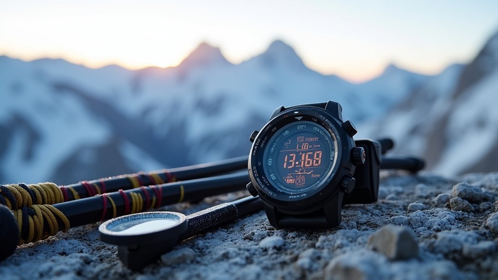
GPS Barometric Watches With Altitude Measurement Capabilities
When you’re tracking elevation changes during alpine adventures, GPS barometric watches combine the precision of air pressure measurement with satellite positioning to deliver accurate altitude readings.
These hybrid systems outperform GPS-only devices by using barometric data as the primary elevation source while GPS enhances location tracking.
Barometric sensors provide superior altitude accuracy compared to GPS alone, making hybrid watches the gold standard for mountain elevation tracking.
You’ll find these watches include additional features like compasses and heart rate monitors for thorough outdoor tracking. They can predict weather changes by monitoring barometric pressure trends, giving you valuable forecasting capabilities in the mountains.
However, you’ll need to calibrate them periodically at known elevations to maintain accuracy. Keep the sensor port clear of debris and water to ensure accurate readings between the watch buttons.
Popular brands like Garmin, Suunto, and Polar offer reliable models, though expect higher costs and frequent charging when GPS features are active during extended alpine excursions.
Smartphone Apps With Barometric Sensors for Elevation Monitoring
Modern smartphones offer a convenient alternative to dedicated watches, with many devices now equipped with built-in barometric sensors that enable accurate elevation tracking through specialized apps.
You’ll find several excellent options like Barometer & Altimeter App, which combines GPS with pressure sensors for thorough altitude measurement. The Barometer Sensor App delivers precise readings when your phone has the required hardware, while Barograph App tracks atmospheric pressure changes on iOS devices.
These apps don’t just measure elevation—they provide weather integration, GPS coordinates, and customizable notifications for pressure changes.
You can calibrate readings manually or through GPS for enhanced accuracy. Many feature analog-style displays and offer data logging capabilities, making them valuable tools for hiking, weather forecasting, and health monitoring related to barometric pressure sensitivity. Rising pressure readings typically indicate fair weather approaching, while falling readings suggest potential storms.
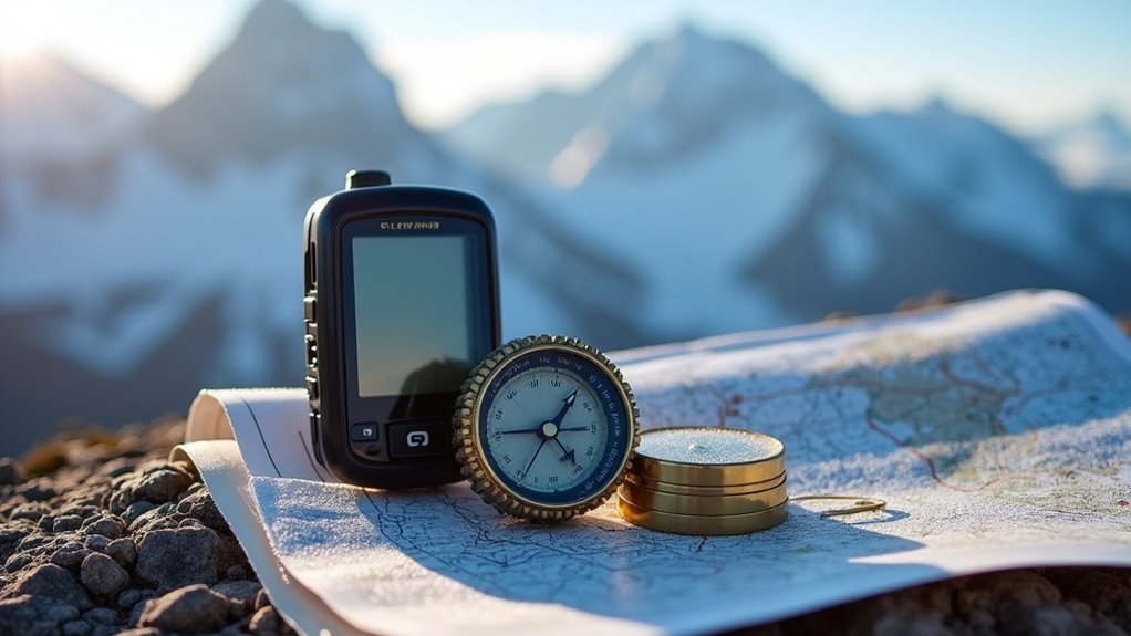
Standalone Digital Altimeters for Precise Height Tracking
While smartphone apps provide convenient elevation tracking, standalone digital altimeters deliver unmatched precision and reliability for serious alpine pursuits.
You’ll get altitude measurements accurate to within one meter, covering ranges from -1,000 to over 55,000 feet. These devices combine altimeter, barometer, and thermometer functions while displaying vertical speed and density altitude simultaneously.
You can store altitude history and track maximum climbing records for later analysis. The waterproof, lightweight construction guarantees durability in harsh mountain conditions, while backup batteries maintain operation when power fails.
Advanced calibration processes and thermal compensation prevent measurement drift, giving you consistent readings you can trust. Modern units feature sunlight readable displays with high contrast screens that remain visible even in bright mountain conditions.
With user-adjustable pressure settings and easy unit conversion between meters and feet, you’ll have professional-grade elevation tracking in your pack.
Frequently Asked Questions
How Often Should I Calibrate My Altimeter Watch During a Multi-Day Climb?
You should calibrate your altimeter watch at least once daily during multi-day climbs. Recalibrate after significant weather changes, when passing known elevation points, and consider multiple daily calibrations in dynamic conditions.
Do Temperature Changes Affect Barometric Pressure Readings on Alpine Gear?
Temperature changes directly affect your barometric pressure readings. When temperatures drop, you’ll see increased pressure, while warmer conditions decrease pressure. This impacts your altimeter’s accuracy, requiring calibration adjustments for precise elevation tracking.
What Backup Elevation Tracking Methods Work When Electronic Devices Fail?
You’ll rely on topographic maps with known benchmarks, visual navigation using terrain features, and analog altimeters as backup. Pre-plan routes with elevation data and develop experience reading landscape cues for reliable navigation.
How Do I Maintain Accuracy When Crossing Different Weather Systems?
You’ll need to recalibrate your altimeter at known elevation points when weather systems change. Use GPS cross-references, monitor barometric pressure trends, and make manual adjustments to compensate for weather-induced drift.
Which Elevation Tracking Gear Works Best in Extreme Cold Conditions?
You’ll want the Garmin GPSMAP 67 with barometric altimeter for extreme cold tracking. It operates down to -40°C, offers 25-hour battery life, and maintains IP67 waterproofing for reliable alpine elevation measurement.
In Summary
You’ve got three solid options for tracking elevation in the mountains. GPS barometric watches offer convenience and multiple features, smartphone apps provide accessibility with decent accuracy, and standalone altimeters deliver precision when you need exact measurements. Choose based on your specific needs, budget, and how critical accurate elevation data is for your alpine adventures. Don’t head into the backcountry without reliable elevation tracking—it’s essential for navigation and safety.


Leave a Reply