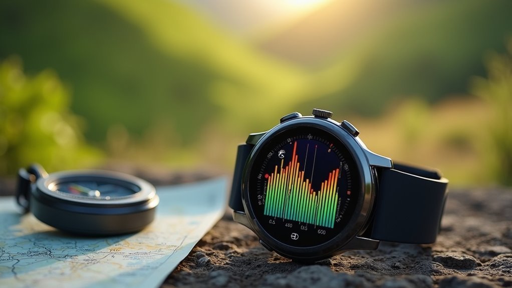
Your smartwatch measures vertical gain using barometric pressure sensors that detect atmospheric changes as you climb, working alongside GPS for thorough elevation tracking. You’ll need to calibrate your starting altitude reference point and understand that GPS readings may differ from barometric data due to signal delays and environmental interference. Dense forests, urban areas, and weather conditions can affect accuracy, so clean your sensor ports regularly and recalibrate after flights or significant weather changes. These fundamentals will reveal advanced tracking insights.
What Elevation Gain Actually Measures Vs Distance Traveled
Confusion often arises when you’re trying to understand what your smartwatch actually tracks during outdoor activities.
Elevation gain measures your total vertical ascent, summing all uphill climbs regardless of how far you’ve walked horizontally. It’s purely about climbing – if you walk five miles on flat ground, you’ll get zero elevation gain.
Distance traveled, however, tracks the total ground you’ve covered from start to finish.
Your smartwatch separates these metrics because they measure completely different things. You could climb 1,000 feet in elevation gain over just one mile of distance on a steep trail, or achieve the same elevation gain over ten miles on a gradual incline.
The elevation stays the same, but distance varies drastically. Most basic fitness watches don’t incorporate gradient data when calculating your actual speed and distance measurements, which can lead to less precise performance tracking on hilly terrain.
How Barometric Pressure Sensors Calculate Vertical Movement
Your smartwatch calculates vertical movement by detecting changes in barometric pressure as you move up or down.
The device continuously monitors air pressure through its built-in sensor, since pressure decreases predictably with altitude gain and increases when you descend.
When the sensor detects these pressure variations over time, it converts them into vertical distance measurements using established atmospheric formulas. The watch provides real-time updates during your activities through continuous measurement capabilities.
Barometric Pressure Basics
Barometric pressure sensors in smartwatches detect vertical movement by measuring minute changes in air pressure that occur as you move up or down. Your watch uses the exponential barometric equation p(z) = p₀e^(-zgm/kT) to convert pressure readings into altitude calculations based on the International Standard Atmosphere model.
| Altitude Change | Pressure Response | Detection Method | Typical Use |
|---|---|---|---|
| Small movements (<5m) | High sensitivity mode | Barometric priority | Stair climbing |
| Rapid elevation | Real-time conversion | Continuous monitoring | Hiking ascents |
| Weather variations | Algorithm filtering | Pressure differentiation | Activity tracking |
| Slow changes | Enhanced sensitivity | Barometric mode switch | Daily elevation |
Your smartwatch continuously monitors these pressure variations, using algorithms to distinguish between altitude changes and weather-induced pressure fluctuations for accurate vertical gain measurements. The sensors work because pressure increases with decreasing elevation due to the weight of the gas above, making it possible to precisely detect even small vertical movements in your daily activities.
Pressure Change Detection
Smart algorithms in your watch transform raw pressure readings into precise vertical movement calculations through sophisticated mathematical processes. Your device uses the exponential barometric equation p(z) = p₀ e^(-mgz/kT), which relates pressure to altitude through gas properties and gravity constants.
The watch simplifies this complex equation using Taylor polynomial approximation, creating a linear relationship between pressure changes and vertical velocity.
When you move vertically, your watch’s pressure sensor detects voltage changes proportional to atmospheric pressure variations. The device calculates your vertical velocity by time-differentiating these sensor signals.
Temperature compensation guarantees accurate readings by isolating pressure changes caused solely by altitude shifts rather than weather fluctuations. Modern smartwatches utilize I2C interface communication protocols to ensure rapid data transfer between the barometric sensor and processing unit. This mathematical foundation enables your smartwatch to distinguish between actual vertical movement and environmental pressure variations, providing reliable elevation tracking.
Setting Your Starting Altitude Reference Point Correctly
Before you can track meaningful vertical gain during your hikes or climbs, you’ll need to establish an accurate starting altitude reference point on your smartwatch.
| Watch Brand | Reference Setting Method |
|---|---|
| Casio Pro Trek | Pull out crown, adjust value in altimeter mode |
| Suunto Ambit3 | Select FusedAlti or manual setting from menu |
| Suunto General | Use FusedAlti combining GPS and barometric data |
| Manual Method | Input known altitude from maps or GPS data |
| Calibration Check | Update sea-level pressure regularly |
You’ll achieve the most accurate readings by using known altitudes from topographic maps or GPS devices to manually set your reference point. Many modern smartwatches offer FusedAlti technology, which combines barometric sensors with GPS data for enhanced accuracy. Remember to recalibrate regularly, as atmospheric pressure changes can cause altitude drift throughout your adventure.
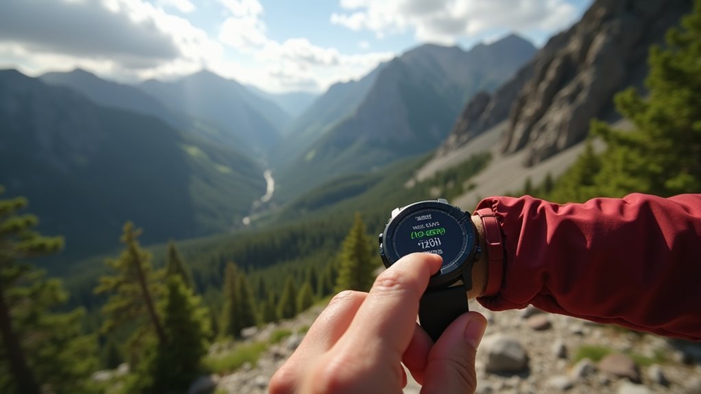
During your trek, the second hand will continuously show the difference between your current position and the reference altitude you established at the start. This differential measurement helps you track exactly how much elevation you’ve gained or lost as you move through varying terrain.
Understanding Why GPS and Barometric Readings Differ
When you notice different altitude readings on your smartwatch during the same hike, you’re witnessing the fundamental differences between two distinct measurement technologies. GPS calculates geometric height above a reference ellipsoid using satellite signals, while barometric altimeters detect atmospheric pressure changes against calibrated sea-level pressure.
Your smartwatch’s conflicting altitude readings reveal the distinct technologies at work: GPS satellites versus barometric pressure sensors.
These technologies respond differently to real-world conditions:
- Response Time: GPS altitude updates can lag during rapid elevation changes, while barometric readings track pressure changes in real time.
- Accuracy Range: GPS vertical accuracy typically ranges ±20-25 meters, but barometric sensors provide better short-term elevation change sensitivity.
- External Factors: GPS faces satellite geometry issues and signal obstructions, while barometric readings drift from weather variations and require periodic calibration.
Understanding these differences helps you interpret your smartwatch’s elevation data more effectively. Among popular brands, Coros watches have demonstrated superior elevation tracking accuracy compared to their competitors.
Environmental Factors That Affect Elevation Accuracy
While your smartwatch’s internal sensors work to measure elevation changes, the world around you constantly influences their accuracy.
Weather changes directly impact barometric altimeter readings since atmospheric pressure fluctuations alter elevation measurements. Temperature variations and humidity levels can affect your device’s electronic components, potentially skewing results.
Your surroundings matter too. Dense forests, urban canyons with tall buildings, and mountainous terrain can interfere with GPS signals, making elevation tracking less reliable.
The urban canyon effect particularly causes GPS signal reflections that create measurement errors.
Geographic features like water bodies and unique geological formations may require you to recalibrate your device more frequently. GPS watches have an accuracy tolerance of +/- 10m for elevation measurements, which means some variation is normal and expected.
You’ll notice these environmental factors working together, creating compound effects that can greatly impact your smartwatch’s ability to accurately track vertical gain during activities.
Using Vertical Speed Metrics for Climb Pacing
As you tackle steep ascents during hiking or trail running, your smartwatch’s vertical speed metric becomes a powerful pacing tool that measures how quickly you’re gaining elevation over time.
This real-time feedback helps you distribute energy efficiently and avoid early burnout during challenging climbs.
Here’s how to maximize vertical speed for effective pacing:
- Set target ranges – Establish vertical speed goals based on your fitness level and climb objectives.
- Monitor real-time data – Adjust your pace immediately when readings deviate from your planned targets.
- Practice consistency – Use repeated feedback sessions to develop better pacing instincts.
Your smartwatch calculates vertical speed by dividing elevation gain by time spent ascending, giving you precise control over your climb intensity and helping you maintain sustainable effort throughout your adventure. Many devices use a pressure sensor rather than GPS alone, which provides more accurate readings during rapid elevation changes on technical terrain.
Monitoring Heart Rate Zones During Steep Ascents
When you’re climbing steep terrain, your heart rate will spike into anaerobic zones much faster than on flat ground, making zone management critical for sustaining your ascent.
You’ll need to actively monitor your smartwatch’s heart rate data and adjust your pace before you hit Zone 4 or 5, where you can’t maintain effort for extended periods.
Smart pacing means using this real-time feedback to optimize your climbing strategy, allowing you to push hard on shorter sections while recovering in lower zones during gentler grades. Testing your smartwatch on actual trail conditions helps verify that the elevation and heart rate data you’re relying on for pacing decisions is accurate.
Anaerobic Zone Management
Because steep ascents rapidly push your heart rate beyond aerobic thresholds, smartwatches become essential tools for monitoring when you’ve entered the anaerobic zone—typically occurring at 80-90% of your maximum heart rate. Your device tracks physiological indicators like rapid breathing and muscle fatigue through real-time HR data.
Effective anaerobic zone management requires three key strategies:
- Set zone alerts – Configure notifications when entering anaerobic zones to maintain awareness.
- Adjust pacing immediately – Use real-time feedback to slow down before lactate accumulation becomes overwhelming.
- Review post-activity data – Analyze HR and elevation profiles to identify patterns and optimize future climbs.
Your smartwatch’s sensor fusion technology combines HR monitoring with elevation tracking, enabling data-driven pacing decisions that help you avoid unsustainable effort levels during challenging ascents. Remember that elevation data updates in intervals rather than continuously, which may create brief delays in your real-time climb metrics.
Pacing Strategy Optimization
While your heart rate zones remain physiologically constant, steep terrain fundamentally changes how your body reaches those thresholds. Your perception of exertion increases dramatically during vertical climbs, even when maintaining what feels like consistent pacing.
You’ll notice your heart rate drifting into higher zones despite steady effort because steep ascents demand greater muscle activation and increased oxygenated blood flow.
Using your smartwatch’s vertical gain data alongside heart rate monitoring creates a complete effort picture. When real-time terrain feedback shows significant elevation gain, adjust your pace to keep heart rate within sustainable zones.
This prevents premature fatigue on long climbs. You’ll maintain energy reserves by consciously slowing when vertical gain spikes, allowing your cardiovascular system to handle the increased workload without exceeding your target zones. Keep in mind that your watch may underestimate elevation gain by 200-300 feet on average, so use the data as a relative indicator rather than an absolute measurement.
Calibrating Personal Metrics for Better Measurement Precision
How can you guarantee your smartwatch delivers the most accurate vertical gain measurements possible? Start by calibrating your elevation when you arrive at locations with known exact elevations from topographic maps or elevation markers. Your watch’s barometric altimeter measures pressure changes that correlate with altitude, but weather patterns can affect these readings.
Here’s your calibration checklist:
- Manual calibration – Enter known elevation values at trailheads or summits for baseline accuracy.
- Post-travel recalibration – Reset after flights or significant weather changes that affect atmospheric pressure.
- Sensor alignment – Allow your watch’s IMU to calibrate using gravity vectors and acceleration data for proper orientation.
Remember to recalibrate periodically, especially after events affecting pressure sensors. Keep the sensor port clean by rinsing away any debris that could affect barometric readings.
Combining barometric data with GPS elevation compensates for individual method weaknesses, delivering more precise vertical gain measurements.
Troubleshooting Common Elevation Tracking Errors
When your smartwatch’s elevation tracking goes wrong, you’ll need to identify whether the problem stems from calibration issues, environmental factors, or GPS connectivity.
Weather changes can throw off your barometric readings, while poor satellite reception in dense forests or urban canyons will compromise your vertical gain accuracy. Additionally, blocked sensor ports can result in incorrect elevation readings and inaccurate floors climbed measurements.
You can resolve most elevation errors by recalibrating your device at known reference points, adjusting for weather conditions, and ensuring you’ve got clear GPS signal access.
Calibration and Reference Points
Because elevation tracking errors can greatly impact your smartwatch’s vertical gain measurements, understanding proper calibration techniques becomes vital for accurate data collection.
Your watch offers multiple calibration methods to guarantee reliability.
When calibrating your altimeter, you’ll need to choose the most appropriate method for your situation:
- GPS calibration – Quick but limited to ±10-foot accuracy; requires clear sky view outdoors
- DEM calibration – Uses map-based elevation data for improved precision; needs internet connectivity and app pairing
- Manual calibration – Enter known elevation from topographic maps or landmarks for highest accuracy
You should calibrate frequently, especially before elevation-intensive activities. Weather changes can cause atmospheric pressure fluctuations that affect your altimeter’s accuracy throughout the day.
Auto mode automatically switches between altimeter and barometer functions, while manual modes let you lock specific tracking preferences based on your terrain and weather conditions.
Weather Impact Solutions
While proper calibration sets the foundation for accurate readings, environmental factors can still throw off your smartwatch’s elevation measurements even after you’ve established reliable reference points.
| Weather Condition | Solution |
|---|---|
| Blocked sensor ports | Clean ports before activities, especially in wet/dirty conditions |
| Rapid pressure changes | Confirm sensor exposure to ambient air; avoid tight sleeves |
| Condensation buildup | Allow moisture to evaporate; avoid protective covers blocking sensors |
| Poor connectivity areas | Enable GPS, Bluetooth, and location services during use |
| Persistent sensor errors | Force restart both watch and phone to reset calibration |
Regular maintenance prevents most weather-related issues. Clean your sensor ports routinely, keep connections active, and confirm your watch isn’t trapped under clothing that blocks environmental exposure. During windy conditions, consider wearing a sleeve over your watch to protect against inaccurate sensor readings that can compromise elevation tracking accuracy.
GPS Signal Issues
Three primary factors contribute to GPS-related elevation errors in smartwatches: satellite geometry, signal obstructions, and urban interference.
When satellites are poorly positioned, your watch can’t accurately triangulate vertical position. Earth’s curvature blocks essential satellites, reducing measurement precision. Additionally, weak signals compromise elevation data quality, particularly in obstructed areas.
Urban environments present unique challenges:
- Tall buildings create signal multipathing – GPS signals bounce off structures, causing inaccurate readings.
- Device interference disrupts signal quality – Other electronics can compromise your watch’s GPS reception.
- Terrain and vegetation affect signal strength – Dense forests or mountainous areas limit satellite visibility.
You’ll notice GPS altitude measurements can vary greatly, sometimes exceeding 400-foot errors. Environmental factors such as windy conditions can also cause your smartwatch’s barometric sensor to produce inaccurate elevation readings during outdoor activities.
Understanding these limitations helps set realistic expectations for your smartwatch’s vertical tracking capabilities in challenging environments.
Analyzing Your Vertical Gain Data in Companion Apps
Although your smartwatch captures vertical gain measurements during activities, you’ll need to explore its companion app to access the full potential of this data.
Most apps display your daily elevation and vertical gain metrics through charts, graphs, or organized lists that reveal patterns over time. You can track historical trends spanning weeks or months, helping you monitor progress and identify training patterns.
Historical trends spanning weeks or months help you monitor progress and identify key training patterns over time.
Many apps group your vertical gain by activity type—hiking, running, or cycling—allowing targeted analysis of specific pursuits. Interactive features let you zoom into particular timeframes or filter data by date ranges.
The apps integrate vertical gain with broader training metrics like heart rate and recovery status, providing thorough performance insights that help optimize your workouts. Advanced fitness apps can achieve exercise recognition accuracy rates of nearly 90% when tracking specific movements and activities.
Frequently Asked Questions
Can I Track Vertical Gain Accurately While Swimming or Doing Water Sports?
You can’t accurately track vertical gain while swimming or doing water sports. GPS signals don’t penetrate water effectively, and barometric sensors struggle with water pressure, making elevation measurements unreliable underwater.
Do Different Smartwatch Brands Calculate Vertical Gain Using the Same Methods?
No, you’ll find different smartwatch brands don’t use identical methods for calculating vertical gain. Each brand employs proprietary algorithms, varying sensor combinations, and different data processing approaches, resulting in measurement differences between devices.
How Much Battery Life Does Continuous Elevation Tracking Consume During Long Hikes?
Continuous elevation tracking can cut your watch’s battery life in half during long hikes. You’ll get 12-36 hours depending on your model, with GPS combination draining power fastest.
Can I Export Vertical Gain Data to Third-Party Fitness Platforms?
You can export vertical gain data to platforms like Strava, TrainingPeaks, and FitnessSyncer. Garmin offers the best export options through Connect, while other brands provide limited functionality through their apps.
Does Wearing the Watch on Different Wrists Affect Elevation Measurement Accuracy?
You won’t see significant differences in elevation accuracy between wearing your smartwatch on your left or right wrist. Arm movement during activities affects readings more than wrist choice itself.
In Summary
You’ve now got the tools to maximize your smartwatch’s elevation tracking capabilities. Remember to calibrate your device before each adventure, understand that barometric and GPS readings won’t always match, and don’t ignore environmental factors affecting accuracy. Monitor your heart rate during climbs, analyze your data post-workout, and troubleshoot issues as they arise. With proper setup and understanding, you’ll get reliable vertical gain measurements for all your outdoor pursuits.


Leave a Reply