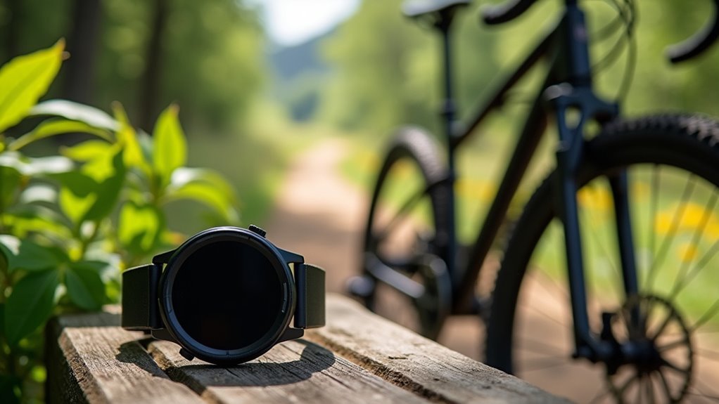
Your cycling watch should track total elevation gain to measure overall ascent, current altitude for real-time positioning, and cumulative elevation loss to understand descent patterns. You’ll want elevation profiles that visualize terrain changes, net elevation change between start and finish points, and climb rate to monitor your ascending speed. Integrating these metrics with heart rate and power data provides thorough performance analysis. Barometric sensors offer superior accuracy over GPS alone for vertical measurements, helping you optimize your climbing strategy and training effectiveness.
Core Elevation Metrics Every Cyclist Needs
When you’re tracking your cycling performance, elevation metrics provide essential data that transforms basic ride statistics into actionable insights for training and route planning.
You’ll need three fundamental elevation measurements: elevation gain, elevation loss, and net elevation change.
Elevation gain tracks your total vertical climbing during a ride, vital for evaluating effort on hills and mountainous terrain.
Elevation loss measures total descent, helping you understand downhill sections and recovery periods.
Net elevation change shows the difference between your start and end elevation, which aids in route difficulty evaluation.
For accurate tracking, you’ll want a watch with barometric altimeters rather than relying solely on GPS.
These core metrics become even more valuable when paired with power output data to measure your climbing efficiency effectively. Modern cycling watches can display an elevation profile that visualizes your route’s vertical changes throughout the entire ride.
Real-Time Altitude Tracking and Display Options
Understanding these core metrics sets the foundation for leveraging your watch’s real-time altitude capabilities during rides.
Your watch’s barometric altimeter delivers more accurate elevation readings than GPS alone, displaying current altitude directly on your main workout screen. You’ll see elevation profiles for the last 30 minutes visualized in graphs, with color-coded displays helping you rapidly interpret changes.
Set up alerts to notify you when reaching preset altitude thresholds, and customize data fields to prioritize elevation over other metrics. Turn-by-turn navigation apps show elevation alongside route progress, while Komoot integration provides terrain difficulty feedback. Some models provide blood oxygen level readings and acclimatization data for altitude.
However, you’ll need to calibrate your barometric sensor at ride start since atmospheric pressure changes affect accuracy.
Cumulative Elevation Gain and Loss Measurements
When you’re cycling, your device tracks cumulative elevation gain by summing all uphill segments while ignoring descents, giving you a clear picture of the physical demands you’ve faced.
You’ll find that measuring descent accurately proves more challenging since most devices prioritize ascent data, though barometric pressure sensors provide more reliable readings for both climbing and descending than GPS alone. Some users experience display problems where their watch shows dashes or missing values instead of elevation metrics, which can frustrate cyclists who rely on this data for training analysis.
Understanding both metrics helps you evaluate your ride’s true difficulty and plan your training more effectively.
Tracking Total Ascent
As you tackle challenging climbs and descents during your rides, tracking total ascent becomes essential for understanding your cycling performance and route difficulty. Your bike computer calculates this metric by measuring cumulative elevation gain throughout your entire ride, capturing every upward movement regardless of subsequent descents.
Modern devices use barometric pressure sensors combined with GPS technology to deliver accurate real-time measurements. You’ll find barometric altimeters particularly reliable since they’re less affected by GPS signal inconsistencies. Your device employs sophisticated algorithms and higher sampling rates to precisely record elevation changes as they occur.
This data helps you assess ride difficulty, plan training sessions effectively, and set meaningful performance goals. Total ascent proves particularly valuable for evaluating overall effort when navigating hilly terrain sections. By analyzing total ascent alongside other cycling metrics, you’ll gain thorough insights into your endurance capabilities and route challenges.
Measuring Descent Accurately
While tracking ascent provides valuable insights into your climbing performance, measuring descent accurately presents unique challenges that require sophisticated technology and proper setup. GPS alone often delivers inaccurate elevation data due to satellite signal fluctuations, making it unreliable for precise descent tracking.
You’ll achieve better accuracy by combining GPS with barometric pressure sensors, which provide real-time altitude measurements based on atmospheric pressure changes. Advanced smoothing algorithms eliminate extraneous variations in your elevation data, creating more consistent readings.
Regular device calibration is essential for maintaining accuracy over time. Environmental factors like weather can affect barometric sensors, so you should validate your data against known elevation profiles. Modern cycling computers also track performance condition during descents, allowing you to assess how your real-time capabilities compare to your average fitness level while navigating downhill terrain.
This multi-sensor approach with proper calibration guarantees you’re getting reliable cumulative elevation loss measurements during your descents.
Visual Elevation Profiles and Data Representation
Since elevation data alone provides limited insight into route difficulty, visual elevation profiles transform raw metrics into intuitive graphical representations that reveal the true character of your cycling route.
These line graphs plot distance against elevation, showing exactly where climbs and descents occur along your path.
You’ll find the most valuable profiles display cumulative elevation gain rather than simple start-to-finish differences, since total climbing effort matters more than net elevation change.
Look for profiles that distinguish positive elevation (climbs) from negative elevation (descents) using color gradients or slope percentages.
Modern cycling computers and apps generate these profiles by uploading GPS data, often smoothing out GPS errors while maintaining accuracy through barometric altimeter readings for reliable route analysis. Many platforms also support various file formats like GPX, KML, and GeoJSON for importing existing route data.
Integration With Heart Rate and Power Monitoring
When you combine elevation data with heart rate and power monitoring, cycling computers transform into all-encompassing performance analysis tools that reveal how terrain directly impacts your physiological effort.
You’ll track time spent in different heart rate zones during climbs, providing ideal performance analysis for hill training. Power zone tracking requires setup in Settings but delivers essential insights into your energy expenditure across varying elevations.
Heart rate zone tracking during climbs delivers essential performance insights for analyzing your energy expenditure across different elevations.
Your watch displays current and average heart rate alongside power output, letting you correlate how climbing affects both metrics.
Functional Threshold Power estimates help gauge your hour-long climbing capacity. Through segmented performance analysis, you’ll understand exactly how elevation changes influence your physiological responses, enabling data-driven training adjustments that improve your climbing efficiency and overall cycling performance. Additionally, you can review all health data through the Health app for comprehensive insights into how elevation training affects your overall fitness metrics.
GPS Accuracy and Barometric Sensor Technology
You’ll find that GPS and barometric sensors each bring distinct strengths and weaknesses to elevation tracking on your cycling computer.
GPS provides excellent horizontal positioning but struggles with precise altitude measurements, while barometric sensors excel at detecting vertical changes through pressure variations. Modern devices often feature multiple satellite links that can improve overall elevation tracking performance compared to basic GPS receivers.
Understanding how environmental factors interfere with these technologies and mastering proper calibration techniques will dramatically improve your elevation data’s accuracy.
GPS Vs Barometric Precision
While both GPS and barometric sensors measure elevation, they accomplish this task through fundamentally different technologies that each offer distinct advantages for cyclists.
GPS excels at providing accurate absolute elevation readings and remains unaffected by weather conditions, eliminating calibration needs. However, it updates slower and struggles with tracking elevation changes during rides.
Barometric altimeters shine when tracking elevation gain and loss, responding quickly to terrain changes with real-time data updates. They’re particularly valuable for mountain biking where precise climb tracking matters.
Unfortunately, weather pressure changes can skew readings, and you’ll need regular calibration. Periodic calibration of watches with barometric altimeters is essential for maintaining optimal accuracy over time.
For ideal results, you’ll want both technologies working together, as many modern cycling watches combine GPS and barometric data to maximize accuracy.
Altitude Calibration Methods
Accurate altitude readings depend on proper calibration, and modern cycling devices offer several methods to achieve this precision. Your watch can automatically calibrate using GPS signals combined with Digital Elevation Models (DEMs), or you can manually input known elevations at reference points.
| Method | Accuracy | Best Use Case |
|---|---|---|
| GPS + DEM | High | Open terrain rides |
| Barometric | Moderate | Continuous tracking |
| Manual Input | Variable | Known elevation points |
Barometric sensors measure air pressure changes to estimate altitude continuously, even without GPS signal. However, weather conditions can affect their accuracy, requiring periodic recalibration. GPS calibration takes several minutes and works best in open areas. Most cycling devices come with factory calibration already completed, providing a solid baseline for altitude measurements. For ideal results, you’ll want devices that combine multiple data sources and offer automatic correction tools for post-ride analysis.
Environmental Interference Factors
Even with proper calibration, environmental factors can greatly disrupt your cycling computer’s ability to track elevation accurately.
GPS accuracy suffers when buildings, dense tree cover, or canyon walls block satellite signals. Your device needs access to multiple satellites for precision, but environmental obstacles reduce this connectivity.
Fast cycling speeds can also cause GPS sampling issues, leading to smoothed-out elevation data that misses true climbs and descents.
Barometric sensors face different challenges. While they don’t rely on satellites, they’re highly sensitive to weather changes.
Sudden temperature shifts, storm systems, or rapid pressure changes can throw off your elevation readings considerably. Built-in sensors like accelerometers and barometers can provide additional data points that help compensate for GPS interference in challenging environments.
Dense forests can create temperature microclimates that affect barometric pressure, while wind patterns in mountainous terrain introduce additional pressure variations that your sensor interprets as elevation changes.
Customizable Alerts for Elevation Changes
How can you guarantee you’re alerted to significant elevation changes during your rides without constantly checking your device?
Customizable elevation alerts solve this by triggering notifications when you ascend or descend past your defined thresholds in meters or feet. You’ll receive vibrations, visual cues, or audible signals depending on your device’s capabilities.
Stay informed about terrain changes through personalized alerts that deliver vibrations, visual signals, or audio notifications based on your elevation thresholds.
Your watch can monitor rapid elevation gains over short distances, displaying live altitude data with profile graphs.
These alerts integrate seamlessly with heart rate, cadence, and power metrics, triggering special screens when crossing threshold elevations. You can activate real-time acclimation reminders for adaptive training, helping you pace effort on steep climbs. When training above 800 m, your device provides altitude acclimation notifications to help optimize your performance adaptation.
All elevation events get logged automatically for post-ride analysis and performance tracking.
Advanced Analytics for Performance Optimization
While basic elevation tracking provides essential ride data, advanced analytics transform this information into actionable insights that’ll optimize your cycling performance.
Your watch should track power profiling metrics that identify strengths and weaknesses across different terrains. Critical power testing through maximal efforts reveals your power output over varying durations, while performance indices compare your results to professional standards.
| Metric | Purpose |
|---|---|
| Elevation Gain Impact | Identifies strength/endurance requirements |
| Altitude Adjustments | Accounts for 16% FTP drop at altitude |
| Power Profiling | Reveals terrain-specific performance patterns |
| Performance Indices | Benchmarks against professional standards |
These analytics help you understand how elevation affects your power output, enabling targeted training adjustments. You’ll develop better pacing strategies and create elevation-specific intervals that build both aerobic capacity and climbing efficiency for measurable performance gains. Early arrival for altitude acclimation helps your body produce more red blood cells, delivering enhanced oxygen to working muscles during high-elevation rides.
Frequently Asked Questions
How Long Does Battery Last When Tracking Elevation Continuously During Rides?
You’ll get 120-145 hours with Garmin Instinct 2X Solar or Coros Dura when continuously tracking elevation. Coros Vertix 2 lasts about six days, while solar charging extends battery life considerably during long rides.
Can Elevation Data Be Synced With Popular Cycling Apps Like Strava?
Yes, you can sync elevation data with Strava and other popular cycling apps. Your GPS-enabled watch automatically transfers detailed elevation metrics, enabling thorough ride analysis, route visualization, and performance tracking.
What’s the Difference Between GPS and Barometric Elevation Accuracy in Mountains?
GPS elevation’s accurate within 20-25 meters but constantly recalculates, while barometric sensors offer few-meter precision after calibration. You’ll get best mountain results combining both methods, since barometric’s more accurate but GPS handles long-distance tracking better.
Do Cycling Watches Work Properly for Elevation Tracking in Cold Weather?
Cold weather greatly affects your cycling watch’s elevation accuracy. Barometric altimeters become less reliable due to temperature sensitivity, while GPS performance may also decline. You’ll need frequent calibration and should consider temperature-compensated models.
How Much Storage Space Do Elevation Profiles Require on the Watch?
Elevation profiles’ storage requirements vary based on your route’s complexity and data resolution. You’ll typically need minimal space since compression techniques reduce file sizes, but longer rides with detailed tracking consume more storage capacity.
In Summary
You’ll maximize your cycling performance by tracking the right elevation metrics on your watch. Focus on real-time altitude, cumulative gain/loss, and visual profiles that integrate with your heart rate and power data. Don’t overlook GPS accuracy and barometric sensors for precise measurements. Set up customizable alerts for elevation changes and use advanced analytics to identify improvement areas. These metrics will transform how you approach climbs and optimize your training effectiveness.


Leave a Reply