
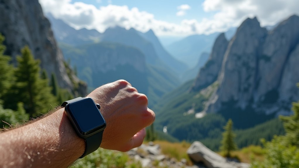
Modern hiking watches now feature multi-constellation GNSS technology, connecting to GPS, GLONASS, Galileo, and BeiDou networks simultaneously. You’ll get improved signal reliability in challenging terrain like dense forests and steep valleys. Consider devices with enhanced antenna design, weatherproofing, and signal amplification features like WAAS technology. Adjusting your GPS intervals conserves battery while maintaining positioning accuracy. Advanced features like barometric altimeters provide backup elevation tracking when satellite signals falter in the backcountry.
Understanding GPS Signal Challenges in Mountainous Terrain
When you venture into mountainous terrain, your GPS device confronts a complex array of signal challenges that can greatly impact navigation reliability.
Mountains create multipath propagation where signals bounce off slopes and valleys, confusing your receiver and causing positioning errors.
Rugged terrain transforms your GPS signals into confused echoes, creating a deceptive digital maze for your navigation device.
The physical landscape itself blocks direct satellite line-of-sight, with high peaks and steep valleys reducing the number of usable satellites for accurate triangulation.
You’ll notice particularly poor reception in deep valleys where satellite visibility is severely limited.
Dense coniferous forests further compound these issues by absorbing and scattering GPS signals.
Even your location within the terrain matters—open ridgetops provide better fix rates than valley floors.
Time of day also affects performance as satellite positions shift relative to the surrounding terrain obstacles.
These challenging conditions constitute a GPS-degraded environment where traditional navigation systems become unreliable and alternative solutions may be necessary.
The Evolution of Wearable GPS Technology for Hikers
You’ve witnessed remarkable changes in wearable GPS devices, from early trackers with limited battery life and spotty coverage to today’s advanced multi-constellation systems that connect with GPS, GLONASS, Galileo, and BeiDou simultaneously.
The miniaturization of powerful antennas and processors has transformed bulky handheld units into sleek wristwatch-sized devices without sacrificing accuracy.
These technological leaps mean your compact wearable can now maintain reliable signals in dense forests and steep canyons where earlier generations would have lost connection entirely. Modern devices like the Garmin Fenix series offer advanced GPS functionality with detailed maps and real-time tracking that revolutionizes how hikers navigate challenging terrain.
Early Tracker Limitations
The adoption of GPS technology by hikers in the early 2000s brought revolutionary navigation capabilities, though early trackers came with significant limitations.
You’d often find yourself frustrated when your signal disappeared in dense forest canopies or deep valleys. These early trackers relied heavily on the satellite navigation system that became fully operational in 1995.
Your experience with these early devices was shaped by:
- Frequent signal interruptions – dense environments like forests and urban canyons would block satellite connections
- Poor battery performance – limiting usability on longer treks
- Basic functionality – lacking modern features like altimeters and accelerometers
- Variable accuracy – depending on device quality and available satellites
While pioneering hikers appreciated the advancement from paper maps, these limitations meant you couldn’t fully rely on early GPS technology, especially in challenging terrain where navigation was most critical.
Multi-Constellation Revolution
Since traditional GPS devices left hikers stranded in challenging terrain, a significant technological leap has transformed outdoor navigation through multi-constellation systems.
Instead of relying solely on America’s GPS satellites, your modern wearable can now access signals from GLONASS, Galileo, and BeiDou simultaneously.
This revolution means you’ll “see” many more satellites at once, dramatically improving positioning reliability even in dense forests or steep ravines.
Multi-frequency capabilities further enhance your experience by reducing atmospheric errors and signal reflections, delivering submeter or even centimeter-level accuracy. Your hiking wearable requires at least 4 satellites for accurate position calculation.
The practical impact? You’ll navigate narrow trails with confidence, experience fewer signal dropouts in backcountry environments, and benefit from advanced features like geofencing and emergency location transmission—all essential when you’re miles from cellular coverage.
Miniaturization Meets Precision
While multi-constellation systems expanded the sky’s coverage, equally impressive advancements have occurred in the physical devices themselves.
Today’s wearable GPS technology offers you unprecedented precision in a remarkably compact form factor, transforming how you navigate wilderness trails.
- Comfort meets functionality – Lightweight materials and miniaturized components create devices you’ll barely notice during long hikes.
- Real-time tracking – Monitor your progress continuously with interactive route guidance that keeps you on path.
- Enhanced safety – Emergency beacons and location sharing capabilities guarantee help can find you precisely when needed. These features have proven invaluable in numerous instances where distress signals enabled timely rescue of injured hikers in remote locations.
- Seamless integration – Your GPS wearable syncs effortlessly with smartphones and other devices, putting extensive navigation at your fingertips.
Multi-Constellation GNSS: Tapping Into Multiple Satellite Networks
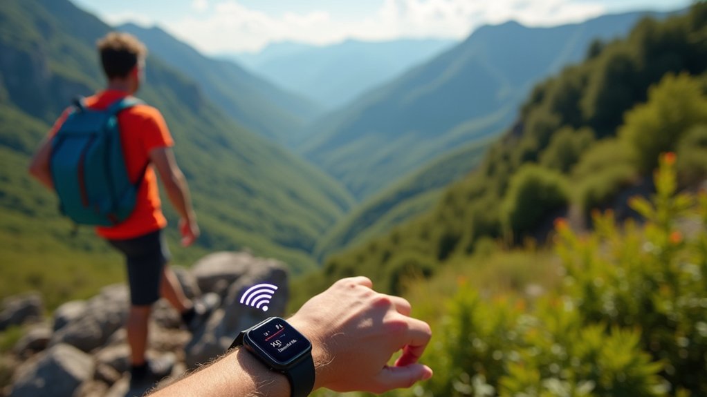
When you’re hiking in challenging terrain, your device’s ability to connect to multiple satellite networks (GPS, GLONASS, Galileo, and BeiDou) dramatically increases your chances of maintaining precise positioning.
While traditional GPS-only receivers might lose signal in dense forests or deep canyons, multi-constellation GNSS technology keeps you oriented by switching seamlessly between available satellite systems. Multi-constellation receivers provide enhanced performance in obstructed environments like dense forest canopies or narrow valleys.
Though GPS offers excellent coverage in North America, you’ll benefit from GLONASS’s superior performance in northern latitudes and urban environments where building interference is common.
Multi-Network Reception Advantages
Although traditional GPS systems have served hikers well for decades, modern multi-constellation GNSS receivers offer game-changing advantages for backcountry guidance.
When you’re deep in a forest or surrounded by mountain walls, these advanced receivers tap into GPS, GLONASS, Galileo, and BeiDou simultaneously. The visual feedback from these systems helps keep hikers oriented while they wait for signal processing to complete.
- Unmatched Signal Availability – Enjoy nearly 100% coverage in challenging environments where single-constellation systems fail
- Enhanced Position Stability – Maintain accurate fixes even when some satellites are obstructed by terrain or dense foliage
- System Redundancy – Continue directing yourself confidently even if one satellite network experiences an outage
- Superior Accuracy – Achieve meter-level precision by comparing multiple signal sources and frequencies, reducing multipath errors common in mountain settings
Your guidance remains reliable even in the most challenging backcountry conditions.
GLONASS Vs GPS Precision
Since most hikers traditionally rely on GPS alone, understanding the distinct advantages of GLONASS can greatly enhance your navigation reliability.
While both systems offer similar precision under ideal conditions, GLONASS excels at high latitudes where GPS often struggles.
Your device’s accuracy improves considerably when it taps into both satellite networks simultaneously. If you’re hiking in areas with dense tree cover or steep terrain, the combined signal redundancy can mean the difference between staying on course and getting lost.
Modern wearables like Garmin’s Fenix series and GPSMAP devices leverage this multi-constellation approach, delivering superior positioning even in challenging environments.
For consistent performance in remote northern regions, you’ll want a device that supports both systems—GLONASS compensates precisely where GPS weakens, especially near mountains or in deep valleys. Additionally, devices that include Galileo compatibility provide even greater positioning accuracy with measurements up to one meter for commercial services.
Signal Amplification Technology in Modern Hiking Watches
The evolution of signal amplification technology in modern hiking watches has transformed outdoor navigation reliability. Your hiking watch now leverages multiple satellite systems and advanced algorithms to maintain connectivity even in challenging terrain.
- WAAS Technology provides real-time corrections to GPS signals, greatly improving your location accuracy when you’re deep in canyons or dense forests.
- Enhanced Antenna Design in watches like the Garmin fenix series optimizes signal reception across varied environments.
- Multi-Satellite Support (GPS, GLONASS, Galileo) guarantees you’ll maintain positioning data even when one system has limited visibility.
- Signal Strength Indicators allow you to reposition for better reception, particularly useful when starting your journey or when surrounded by signal-blocking terrain.
Advanced GPS watches such as the Garmin Forerunner 965 utilize multi-band GPS technology for enhanced location tracking in challenging conditions.
Weatherproofing Your GPS Connection: Technology Solutions
Your GPS signal doesn’t need to falter in harsh weather when you add a weather-resistant signal amplifier to your hiking gear.
These compact devices create a protective bubble around your GPS connection, effectively maintaining satellite communication during downpours or snowfall.
Anti-precipitation GPS shields, which attach directly to your device, offer an additional layer of signal protection by diverting moisture away from critical antenna components.
Unlike smartphones that rely on cellular networks, dedicated GPS devices connect directly to satellites, providing more accurate navigation in remote natural settings where cell service is unavailable.
Weather-Resistant Signal Amplifiers
When traversing challenging terrain in unpredictable weather conditions, reliable GPS connectivity becomes essential for safety and navigation.
Weather-resistant signal amplifiers can maintain your connection even in harsh environments with their rugged construction and protective features.
Today’s high-performance amplifiers offer:
- IP67 waterproof ratings – protecting your device when submerged up to 1 meter for 30 minutes
- Extreme temperature tolerance – functioning effectively from -55°C to +70°C
- Enhanced signal strength – with gains up to +26.5 dB to boost weak signals in remote areas
- Low power consumption – typically using only 15 mA, preserving your device’s battery life
These amplifiers use gold-plated brass construction and high-impact, UV-stable materials to withstand the elements while rejecting interference in crowded RF environments. The addition of built-in LNAs significantly improves signal quality by amplifying weak satellite signals directly at the antenna.
This ensures your navigation stays accurate regardless of conditions.
Anti-Precipitation GPS Shields
Four critical layers of protection shield modern GPS devices from nature’s worst elements while maintaining signal integrity in challenging conditions.
High-impact UV-stabilized polycarbonate enclosures offer superior defense against rain, snow, and salt spray while letting signals pass through unimpeded.
IP67-compliant housings prevent dust and water ingress, making your device truly weatherproof on the trail.
For marine environments, specialized hardened enclosures withstand extreme conditions you’ll encounter near coastlines or during water crossings.
Beyond physical protection, modern GPS shields incorporate anti-jamming technologies like Controlled Reception Pattern Antennas that adjust signal patterns automatically.
These systems, including compact GPS domes for smaller devices, guarantee your location remains accurate even in precipitation.
When selecting hiking GPS tech, prioritize units with sealed electronics and weather-resistant testing certification for reliable performance in any environment.
Properly sized protective enclosures like those from Serpac, measuring about 5.6″ long, accommodate most GPS sensors while ensuring continued satellite reception functionality.
Battery Optimization Techniques for Extended Signal Strength
Maximizing battery life stands as the cornerstone of maintaining reliable GPS signals during extended hiking adventures.
When your device dies, so does your navigation capability, making battery conservation a critical skill for backcountry explorers.
- Adjust GPS intervals wisely – Switch to extended battery modes like Garmin’s UltraTrac with 60-second intervals for multi-day treks, trading slight accuracy for up to 50 hours of runtime.
- Limit satellite systems – Using GPS-only instead of multiple satellite systems greatly reduces power consumption.
- Download offline maps – Prevent continuous data usage while maintaining navigation capability.
- Manage device temperature – Keep batteries warm in cold conditions for ideal performance, and protect from excessive heat during summer hikes. Placing your device in your sleeping bag overnight prevents battery drain caused by cold temperatures.
Comparing Wrist-Mounted vs. Handheld GPS Signal Performance
Choosing the right GPS device format affects your ability to maintain reliable navigation signals in the backcountry just as much as battery management.
Handhelds offer superior signal performance with larger antennas that capture multi-constellation tracking more effectively, translating to better accuracy in challenging terrain.
While wrist-mounted options like the Foretrex 801 provide hands-free convenience, they sacrifice some signal precision due to compact antennas and positioning limitations on your wrist.
You’ll notice this difference particularly under dense tree cover or in steep valleys.
The tradeoff is clear: handhelds deliver stronger reception and detailed map interaction but require one-handed operation, while wrist units offer immediate access and lighter weight but with simpler interfaces and slightly compromised signal strength.
Your navigation priorities should dictate which format best serves your hiking needs.
Premium handheld GPS units like the Garmin GPSMAP 67i provide multi-band capabilities that significantly improve location accuracy in challenging environments.
Advanced Antenna Designs in Compact Wearable Devices
While traditional GPS devices struggle in challenging environments, today’s wearable navigation tools incorporate sophisticated antenna designs that overcome many signal limitations.
Modern hiking wearables utilize textile-integrated antennas with materials like ShieldIt super that provide flexibility without compromising performance.
- Circularly Polarized (CP) Antennas enhance GPS signal reception at 1.575 GHz, maintaining connection even when your wrist is tilted at odd angles on the trail.
- Microstrip and PIFA designs offer the compact form factor you need in a wearable while delivering impressive gain and efficiency.
- Low dielectric constant substrates (around 1.22) minimize signal loss through your device’s materials.
- Strategic on-body placement accounts for your body’s natural interference, positioning antennas for ideal signal strength during movement.
Many advanced hiking wearables now integrate BLE technology that optimizes device performance while maintaining exceptional battery life for extended trips.
Offline Mapping Solutions When Signals Fail
When your GPS signal disappears in remote wilderness areas, reliable offline mapping solutions become your lifeline. Apps like Organic Maps, Gaia GPS, and onX Backcountry offer extensive offline navigation with detailed topographic features, even without internet connectivity.
Navigating off-grid wilderness requires purpose-built offline mapping tools that deliver when cellular connections fail.
You’ll benefit from pre-downloaded maps that include contour lines, elevation profiles, and trail networks powered by OpenStreetMap data. These apps maintain precise location tracking via GPS satellites while conserving battery by keeping cellular radios off.
For maximum preparedness, download regional maps before your trip and utilize the GPX import/export features to transfer pre-planned routes from your computer. Among these options, Caltopo stands out for its stable performance even when handling extensive route data, unlike some alternatives that experience slowdowns or crashes. Most platforms support both iOS and Android, with selective downloading options to minimize storage usage.
Look for apps offering turn-by-turn guidance and offline search to quickly locate landmarks when you’re deep in the backcountry.
Satellite Messaging Systems for Remote Communication
Beyond offline maps, satellite messaging systems represent the next frontier for hikers venturing into remote wilderness. These technologies let you communicate when cell towers are nonexistent, transmitting texts and SOS alerts via orbiting satellites rather than cellular networks.
- Device Options – Choose between dedicated units like Garmin inReach or ZOLEO for reliable two-way communication, or newer smartphones with built-in satellite capabilities. Many top models like the Garmin inReach Mini 2 offer exceptional features in an ultra-lightweight design.
- Emergency Coverage – SOS functions connect directly to search and rescue teams, sending your GPS coordinates automatically.
- Regular Check-ins – Send location updates to loved ones without cell service, providing peace of mind for solo hikers.
- Subscription Requirements – Most systems require monthly or annual plans that determine message limits and coverage areas.
Barometric Altimeters: Complementing GPS in Dense Forests
When your GPS signal weakens under dense forest canopy, a barometric altimeter continues tracking your elevation with remarkable accuracy based on air pressure readings.
You’ll maintain essential trail navigation capabilities by monitoring altitude changes even during complete signal loss, helping identify intersections, peaks, and valleys on topographic maps.
Your device’s battery will also thank you, as barometric sensors consume considerably less power than constantly searching GPS receivers struggling to maintain satellite connections. For optimal performance, ensure you calibrate at reference points when starting your excursion to minimize measurement errors throughout your journey.
Elevation Accuracy During Disconnection
Although GPS technology has revolutionized outdoor navigation, its reliability falters considerably in dense forest environments where signal strength weakens.
When your GPS disconnects under heavy tree cover, elevation readings can drift by as much as ±400 feet, making accurate altitude tracking nearly impossible.
Barometric altimeters offer a reliable alternative during these disconnection periods:
- They maintain accuracy within ±50-75 feet over 12 hours, compared to GPS’s 20-25 meter variance.
- They continue functioning regardless of tree cover since they measure air pressure, not satellite signals.
- They consume less power, extending battery life during long hikes.
- They provide real-time elevation changes with greater consistency when properly calibrated.
For ideal results in dense forests, you’ll want to use both technologies together, calibrating your barometric altimeter at known elevation points throughout your journey. Frequent calibration is essential as barometric altimeters can achieve +/-10 feet accuracy at any elevation point when properly calibrated.
Pressure-Based Trail Navigation
Barometric altimeters offer more than just backup elevation data during GPS disconnections—they’re valuable navigation tools in their own right.
When hiking through dense forests where satellite signals struggle, these pressure-based sensors provide smooth, consistent elevation readings that outperform GPS-only altitude data.
You’ll get the best results by calibrating your device at known elevation points, like trailheads or landmarks. This compensates for weather-induced pressure changes that cause altitude drift.
Throughout longer hikes, recalibrate at benchmarks to maintain accuracy.
Modern wearables integrate barometric altimeters with GPS for extensive navigation solutions.
These ruggedized, waterproof devices offer reliable altitude tracking even under heavy canopy, alerting you to elevation changes and helping you stay on course when traditional GPS elevation data fluctuates unpredictably. The SISCO models deliver impressive measurement accuracy with their 300hPa to 1100hPa range, making them suitable for most hiking elevations.
Battery-Saving Altitude Monitoring
For hikers seeking to extend device runtime on long journeys, barometric altimeters offer significant battery advantages over GPS-only solutions.
These pressure-based sensors provide reliable elevation data even in dense forests where satellite signals struggle to penetrate the canopy.
When conserving power on multi-day treks:
- Use your barometric altimeter as the primary elevation tracker, activating GPS only when necessary for location confirmation.
- Calibrate your altimeter at known elevations using topographic maps to maintain accuracy without constant GPS reference.
- Monitor pressure changes for weather prediction, reducing the need to check forecasts on power-hungry smartphones.
- Switch between altimeter and GPS strategically – altimeter in forests, GPS in open terrain – to optimize battery consumption while maintaining navigation confidence.
Regular recalibration becomes essential during long hikes as readings can drift significantly due to changing weather conditions affecting barometric pressure.
Software Algorithms That Enhance Weak Satellite Connections
When your GPS struggles to maintain a reliable signal on remote trails, sophisticated software algorithms work behind the scenes to maximize every bit of available satellite data.
These systems employ closed-form positioning and two-step determination techniques that maintain accuracy even with noisy measurements.
Your device’s dual-frequency reception (L1 and L5) counters ionospheric distortion and multipath errors while hiking through dense forests or canyon trails.
This technology accelerates your time-to-first-fix and improves reception reliability when satellite signals weaken.
Advanced Kalman filtering fuses GPS data with inertial sensors, allowing your device to track your position even during temporary signal dropouts.
This integration of gyroscopes and accelerometers maintains stable tracking in challenging environments, quickly recovering your position when satellite visibility returns.
Environmental constraints like tall cliffs and thick tree cover can significantly reduce the number of visible satellites, degrading position accuracy on mountainous trails.
Testing Your Wearable’s Signal Strength Before Backcountry Treks
Before venturing into remote wilderness areas where reliable navigation becomes vital, you’ll need to thoroughly test your GPS wearable’s signal strength capabilities. Proper testing guarantees you won’t lose tracking in critical moments when trail markers disappear.
Before entering the wilderness, test your GPS wearable thoroughly. Proper signal verification prevents navigation failures when you need guidance most.
- Conduct baseline testing in open areas to establish normal satellite fix times and connection quality.
- Test in environments similar to your trek destination (forests, canyons, etc.) to identify potential signal challenges.
- Monitor signal-to-noise ratios and visible satellite counts during movement to assess reliability.
- Compare your device’s performance against manufacturer specifications while wearing it exactly as you’d during your hike.
During these evaluations, you may need to hold on while your device processes and verifies the GPS signal quality.
Don’t forget to confirm sufficient battery capacity and updated firmware before conducting these tests.
Future Innovations in Wearable GPS Signal Technology
As hikers venture deeper into remote wilderness areas, groundbreaking innovations in wearable GPS technology are rapidly emerging to address traditional signal limitations. You’ll soon benefit from multi-frequency reception across GPS, GLONASS, Galileo, and BeiDou systems, providing centimeter-level precision even in challenging terrain. Smartwatches with advanced AI features are leading these innovations, offering hikers unprecedented tracking capabilities in remote locations.
| Innovation | Benefit | Timeline |
|---|---|---|
| AI-Driven Signal Processing | Predicts signal loss areas and optimizes reception | 1-2 years |
| Flexible Conformal Antennas | Maintains signal quality during movement | Available now |
| RTK Technology Integration | Centimeter-level positioning accuracy | 2-3 years |
Sensor fusion will guarantee continuous tracking even when GPS signals temporarily fail. Advanced chipsets with MIMO antenna systems will dramatically improve signal acquisition in dense forests while consuming less power, extending your battery life during multi-day adventures.
Frequently Asked Questions
Can GPS Wearables Function in Extreme Cold or Hot Temperatures?
Yes, most GPS wearables function between -20°C and 60°C. You’ll experience reduced battery life in extreme cold, while excessive heat may affect electronic components. Some specialized models offer wider temperature tolerance ranges.
Do GPS Boosting Technologies Increase Radiation Exposure?
Yes, GPS boosting technologies typically increase radiation exposure. You’ll absorb more RF radiation when using signal boosters as they amplify transmission power. However, levels remain within safety guidelines established by regulatory authorities.
Are There GPS Alternatives for Caves and Underground Trails?
Yes, you’ll need GPS alternatives underground. Use inertial navigation systems, digital compasses with pedometers, cave surveying tools like DistoX, or specialized wearables that combine multiple sensors for tracking your position in GPS-denied environments.
How Do Competing Brands Differ in Signal Acquisition Speed?
Garmin tends to excel in quick initial fixes, while Trimble offers superior sensitivity in challenging environments. Magellan falls between them. You’ll notice faster acquisition with higher-end models regardless of brand under clear skies.
Can Hiking GPS Devices Track Multiple Hikers Simultaneously?
Most standard hiking GPS devices can’t track multiple hikers simultaneously. You’ll need specialized devices or apps with satellite communicators and subscription services to enable real-time group tracking during your wilderness adventures.
In Summary
You’ve now seen how wearable tech has revolutionized backcountry navigation. By utilizing multi-constellation systems, signal amplification, and intelligent algorithms, today’s devices keep you connected even in challenging terrain. Don’t forget to test your gear before heading out, and stay informed about emerging technologies. With these advanced tools, you’ll navigate confidently while enjoying the freedom and security that reliable GPS provides on your hiking adventures.


Leave a Reply