You’ll achieve the most precise elevation tracking with watches like the Garmin Instinct 3 Solar, which combines advanced barometric altimeters with multi-band GPS for accuracy within 10-50 feet. The lightweight COROS PACE 3 and Suunto Core offer reliable dual-sensor systems, while the Garmin Forerunner 965 provides extensive elevation metrics. Don’t overlook the Polar Vantage V3’s 43-hour GPS battery life or the Apple Watch Ultra 2’s smart integration capabilities. Each model’s unique features can transform your backcountry navigation experience.
Garmin Instinct 3 Solar: Solar-Powered Precision for Extended Adventures
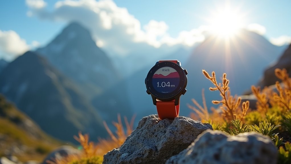
When you’re planning extended backcountry adventures where charging opportunities don’t exist, the Garmin Instinct 3 Solar delivers solar-powered reliability that keeps you connected to critical navigation data.
The solar charging capability extends battery life indefinitely in smartwatch mode with adequate sunlight exposure, making it perfect for thru-hikers and multi-day expeditions. The solar enhancement delivers 5x improved charging power compared to the previous Instinct 2 Solar model.
You’ll get excellent GPS accuracy through multi-band positioning with SatIQ technology, working reliably from mountains to urban areas.
While elevation tracking uses barometric altimeter data that can occasionally show discrepancies, it’s generally more accurate than competing devices.
The rugged 53g construction withstands harsh conditions with 10 ATM water resistance, surviving everything from river crossings to mountain storms without compromising performance or comfort during extended wilderness use.
Suunto Core: Essential Barometric Altimeter With Storm Alert Protection
The Suunto Core delivers essential barometric altimeter functionality at a price point that won’t break your outdoor gear budget, making it an ideal choice for day hikers and weekend warriors who need reliable elevation tracking without premium features.
You’ll get one-meter resolution for elevation changes and storm alert protection that detects barometric pressure shifts. The combined altimeter and barometer work together to provide more accurate readings by accounting for pressure variations.
At just 64 grams, this aluminum-bodied watch won’t weigh you down during long hikes.
You’ll also benefit from compass functionality with adjustable declination, sunrise/sunset times for over 400 locations, and 100-foot water resistance. The watch includes a depth meter that displays underwater measurements up to 10 meters for water activities. The year-long battery life means you won’t constantly worry about charging between adventures.
Garmin Forerunner 965: Advanced Elevation Tracking With Comprehensive Fitness Features
Moving beyond basic barometric functionality, Garmin’s Forerunner 965 combines dual-source elevation tracking with thorough fitness analytics to serve serious hikers and multisport athletes who demand detailed terrain data.
You’ll benefit from both barometric altimeter readings and GPS elevation data working together for thorough altitude measurements. The watch delivers precise metrics including total ascent/descent, maximum rates, and grade percentages that help you analyze challenging terrain effectively.
However, you should expect occasional discrepancies compared to other devices, with some users reporting elevation gain overestimation exceeding 50%. Environmental factors and algorithmic variations can affect accuracy despite auto-calibration features. Incoming weather systems can cause incorrect starting elevation readings, requiring manual calibration to maintain accuracy.
Key elevation metrics include:
- Total elevation gained/lost with lap-specific breakdowns
- Average and maximum ascent/descent rates per minute
- Real-time grade percentage calculations
- Glide ratio measurements for terrain analysis
- Training Effect integration combining elevation with fitness data
COROS PACE 3: Lightweight Design With Reliable GPS Elevation Monitoring
Although it weighs just 29 grams, COROS’s PACE 3 delivers serious elevation tracking capabilities that rival much heavier hiking watches. You’ll get precise readings through its dual-sensor system combining GPS satellite data with an internal barometric altimeter that updates every 1-2 seconds during workouts.
| Feature | Performance |
|---|---|
| Elevation Accuracy | +/- 10 meters |
| Weight | 29 grams |
| Battery Optimization | SatIQ technology |
| Calibration Frequency | Every 30 minutes |
The watch balances barometric and GPS inputs using sophisticated algorithms, ensuring stable readings even in challenging terrain. You can manually enter elevation before activities for enhanced reliability, and the SatIQ technology adjusts GPS sampling rates to extend battery life while maintaining tracking precision. To maintain optimal performance, establish a cleaning routine since exposure to sweat, dust, and environmental sediment can impact the barometric sensor’s air pressure readings over time. It’s an excellent value choice for hikers prioritizing lightweight design without sacrificing elevation monitoring accuracy.
Polar Vantage V3: High-Accuracy Elevation Measurement Despite Software Challenges
Polar’s Vantage V3 delivers impressive elevation tracking accuracy through its dual-frequency GPS antenna and integrated barometer, though you’ll need to navigate some software quirks to access its full capability.
The V3’s elevation performance represents a significant improvement over previous Polar models, which often displayed negative elevation values. You’ll get the most reliable results by manually calibrating altitude at known points before your hike, as auto-calibration can drift during rapid weather changes. The watch’s 43-hour GPS battery life ensures reliable tracking throughout extended backcountry adventures without frequent recharging stops.
Manual altitude calibration at known elevation points delivers the most reliable tracking results, especially during rapidly changing weather conditions.
For ideal elevation tracking performance, follow these recommendations:
- Manually calibrate altitude at known elevation points before activities
- Expect minor software drift in extreme city environments
- Plan for excellent battery life during multi-day adventures
- Utilize detailed post-activity elevation maps and statistics
- Anticipate accuracy comparable to high-end Garmin and COROS devices
Apple Watch Ultra 2: Accurate Elevation Readings With Smart Integration
The Apple Watch Ultra 2 combines barometric sensors with dual-frequency GPS to deliver reliable elevation tracking that integrates seamlessly with your iPhone’s ecosystem.
You’ll get real-time elevation updates with an always-on altimeter, though readings may vary by several feet due to atmospheric pressure changes and weather conditions affecting GPS signals.
The watch displays elevation data as graphs in Apple Maps and syncs with the Workout app for thorough activity tracking.
While you can’t manually calibrate elevation readings, you can improve accuracy by enabling “Precise Location” or unpairing and re-pairing your watch with your iPhone when persistent inaccuracies occur. Some users report that activating water lock can temporarily correct problematic elevation readings.
Despite typical margins of error around ±20 feet, the seamless integration with Apple’s Health ecosystem makes elevation data readily accessible across all your devices.
Key Features to Consider When Choosing Your Elevation Tracking Watch
When selecting an elevation tracking watch, you’ll need to evaluate three critical aspects that directly impact your hiking experience.
First, consider altimeter accuracy standards – barometric altimeters typically provide more precise elevation changes than GPS-only models, though they require regular calibration.
You should also weigh GPS integration benefits against battery life considerations, as continuous GPS tracking offers superior navigation features but considerably reduces your watch’s operating time between charges. Modern hiking watches like the Garmin fenix 8 can deliver up to 84 hours in GPS mode for extended outdoor adventures.
Altimeter Accuracy Standards
Since your hiking watch’s altimeter serves as your primary elevation reference on the trail, understanding accuracy standards becomes essential for making informed gear decisions.
Modern hiking watches typically achieve accuracy within 50-75 feet over 12 hours under stable weather conditions. However, you’ll encounter variables that affect performance.
Environmental factors like rapid weather changes, temperature extremes, and barometric pressure fluctuations can introduce significant errors. Your watch’s sensor quality and calibration frequency directly impact reliability.
Premium models use advanced barometric altimeters with higher resolution and better environmental resistance. Daily calibration against geodetic survey points or known landmarks significantly improves accuracy throughout extended hiking trips.
For recreational hiking, expect these accuracy standards:
- ±50-200 feet over short periods for typical use
- 200-300 feet error after 3,000 feet elevation gain
- 10-20 feet error from small barometric fluctuations
- 50-200 feet drift without regular calibration
- <10 feet accuracy only for professional applications
- Use power-saving modes during rest periods
- Activate GPS tracking only when necessary
- Choose solar-enabled models for extended trips
- Adjust display brightness and update intervals
- Regularly calibrate battery estimates for accuracy
GPS Integration Benefits
GPS integration transforms your hiking watch from a simple barometric altimeter into a sophisticated elevation tracking system that cross-references satellite data with pressure readings. You’ll get considerably improved accuracy as the GPS validates barometric measurements against actual position data, eliminating errors from weather-related pressure fluctuations.
| GPS Feature | Benefit | Impact |
|---|---|---|
| Multi-GNSS Support | Enhanced signal reliability | Better tracking in dense forests |
| Frequent Updates | Real-time elevation monitoring | Accurate ascent/descent data |
| Position Validation | Cross-referenced altitude data | Reduced weather-related errors |
| Auto-calibration | Pressure sensor adjustments | Maintained tracking integrity |
This combination delivers precise elevation-aware fitness metrics, including vertical speed and cumulative gain calculations, while enabling detailed route tracking with waypoints for safer navigation. High-end GPS watches now offer extended battery life compared to previous generations, ensuring your elevation tracking remains active throughout multi-day hiking adventures.
Battery Life Considerations
Battery life becomes your most critical consideration during multi-day hiking adventures, as even the most feature-rich elevation tracking watch won’t help if it dies halfway up the mountain.
You’ll need to balance GPS accuracy with power consumption, as multi-band GPS mode dramatically reduces battery life compared to normal use.
Top performers like the Garmin Enduro 3 and Suunto Vertical Titanium Solar offer 90 hours in GPS mode, while solar charging capabilities extend usage when you’re exposed to sunlight during daylight hiking. The Garmin Enduro 3 stands out with its potentially unlimited battery life, making it ideal for extended remote adventures where charging opportunities are scarce.
Key battery optimization strategies:
Frequently Asked Questions
How Often Should I Calibrate My Hiking Watch’s Altimeter for Accurate Readings?
You should calibrate your altimeter before each hike and every 12 hours during extended trips. Weather changes affect barometric pressure, causing drift. Use known elevation points or GPS data for accurate manual calibration.
Can Elevation Tracking Watches Work Accurately in Extreme Weather Conditions?
You’ll find elevation tracking watches can work in extreme weather, but accuracy may suffer due to rapid pressure changes. You’ll need frequent recalibration and should expect some GPS interference during harsh conditions.
What’s the Typical Elevation Accuracy Difference Between GPS and Barometric Altimeters?
You’ll typically see GPS altimeters accurate within 10-20 feet, while barometric altimeters can achieve 3-10 feet accuracy in stable conditions, though atmospheric pressure changes can create significant discrepancies between readings.
Do Hiking Watches Maintain Elevation Accuracy When Battery Levels Are Low?
Your hiking watch’s elevation accuracy won’t directly suffer from low battery levels, but you’ll notice reduced GPS and altimeter update frequencies. Power-saving modes can impact overall performance while maintaining core functionality.
How Do I Sync Elevation Data Between My Watch and Smartphone Apps?
Download your watch’s companion app, guarantee Bluetooth’s enabled, then tap sync within the app. You’ll need to create an account first. Most watches automatically sync elevation data when they’re within range of your phone.
In Summary
You’ve got excellent options for precise elevation tracking, whether you’re tackling mountain peaks or exploring local trails. Consider your priorities: solar charging for extended adventures, barometric accuracy for weather awareness, or smart features for daily use. Don’t overlook battery life and GPS reliability when you’re miles from civilization. Choose the watch that matches your hiking style and technical needs—you’ll appreciate accurate elevation data when it matters most.


Leave a Reply