
You’ll boost trail running GPS precision by optimizing your device settings, leveraging correction systems, and integrating multiple data sources. First, set your GPS recording interval to one second and reduce displayed data fields to balance accuracy with battery life. Second, implement Real-Time Kinematic (RTK) GPS or Differential GPS systems for centimeter-level precision through real-time correction data. Third, combine your GPS watch data with accelerometer readings and cross-validate routes using multiple devices. These strategies will transform your tracking accuracy on challenging terrain.
Optimize Your GPS Device Settings and Equipment Selection
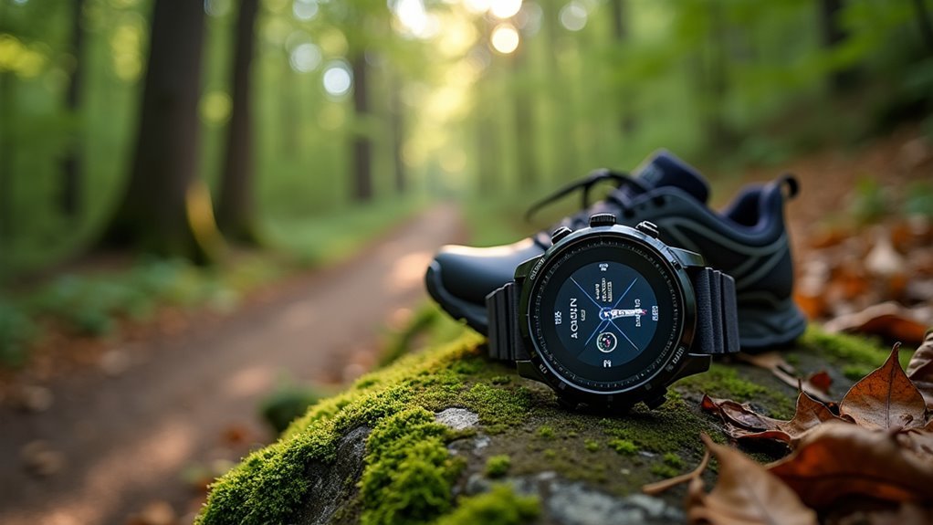
While GPS technology has become increasingly sophisticated, your trail running accuracy still depends heavily on how you configure your device and select compatible equipment.
Start by reducing your GPS recording interval to five-second intervals, which extends battery life while maintaining sufficient accuracy. Limit displayed data fields to improve readability and reduce power consumption.
For equipment selection, consider adding a Stryd foot pod to enhance pace and distance accuracy through direct stride feedback.
Chest strap heart rate monitors provide more accurate data than wrist-based options while consuming less power. You can also integrate additional sensors for power output measurements without compromising GPS precision.
Some devices offer extended antennas or external GPS units that improve signal strength in challenging trail environments. However, for optimal data accuracy, set your recording interval to 1-second intervals, which provides the most precise tracking without significantly impacting battery performance.
Leverage Real-Time Correction Systems and Signal Enhancement
Beyond basic device optimization, you can dramatically improve your trail running GPS accuracy by implementing real-time correction systems that actively enhance satellite signals.
Real-Time Kinematic (RTK) GPS delivers precision down to 1.8 centimeters compared to standard GPS’s 2-meter accuracy. These systems use base stations to provide real-time corrections through differential positioning with dual GPS receivers.
RTK GPS achieves centimeter-level precision through base station corrections, dramatically outperforming standard GPS accuracy by over 100 times.
You’ll benefit from Differential GPS (DGPS) networks that transmit correction data in real-time, reducing multipath effects and improving positioning in challenging environments with limited satellite visibility.
Signal enhancement techniques include using external antennas, leveraging multiple GPS frequencies (L1/L5), and aggregating data from various navigation sources. RTK systems achieve superior accuracy by measuring the carrier wave phase of satellite signals rather than relying solely on code analysis like standard GPS.
However, consider infrastructure costs and complexity. Open-source RTK solutions and publicly available correction services can reduce expenses while delivering professional-grade accuracy for serious trail runners.
Integrate Multiple Data Sources for Enhanced Tracking Accuracy
As GPS technology reaches its hardware limits, you’ll achieve superior trail tracking accuracy by combining multiple data sources that complement and validate each other.
Your GPS watch provides precise distance and pace data, but pairing it with accelerometer readings gives you deeper insights into running dynamics and physical activity patterns.
You can enhance accuracy by integrating data from multiple GPS devices to cross-validate routes.
Leverage GIS software like ArcGIS to overlay your GPS tracks on high-resolution aerial photographs, creating more accurate trail maps. OpenStreetMap offers crowdsourced updates, while Strava heatmaps reveal popular trail segments and usage patterns.
Import your GPX files into mapping platforms and combine them with LIDAR terrain models for detailed topographical information that improves navigation safety and route planning. Consider using apps like Caltopo for route creation and comprehensive analysis capabilities that allow you to upload GPX files and utilize various mapping overlays for enhanced navigation accuracy.
Frequently Asked Questions
How Do Weather Conditions Like Rain or Fog Affect GPS Accuracy?
Rain and fog weaken your GPS signals by absorbing and scattering radio frequencies. You’ll experience slightly reduced accuracy but rarely total signal loss. Wet vegetation creates additional barriers, causing more erratic readings on overgrown trails.
What Terrain Features Cause the Most GPS Signal Interference During Trail Runs?
Dense forests and steep canyons cause you the most GPS interference while trail running. You’ll experience signal blockage from heavy tree cover and poor satellite visibility in deep valleys, creating multipath errors and position inaccuracies.
How Long Should I Wait for GPS Convergence Before Starting My Run?
You should wait 60-90 seconds for GPS convergence before starting your trail run. This guarantees accurate distance, pace, and elevation tracking. Don’t move during this period, and confirm your device shows strong signal acquisition.
Do I Need to Recalibrate My GPS Device for Different Trail Locations?
You don’t need to recalibrate your GPS device when switching trail locations. However, you should recalibrate your compass regularly and verify you’re using consistent GPS datums across different areas for maximum accuracy.
How Much Extra Battery Life Do High-Precision GPS Modes Consume?
High-precision GPS modes consume considerably more battery than standard modes. You’ll see multiband accuracy modes drain roughly 65% more power, reducing your watch’s tracking time from potential hundreds of hours to around 60 hours.
In Summary
You’ll dramatically improve your trail running GPS accuracy by implementing these three strategies. Start by fine-tuning your device settings and choosing quality equipment that’s built for outdoor conditions. Don’t overlook real-time correction systems—they’re game-changers for signal enhancement in challenging terrain. Finally, you’ll get the most reliable data by combining multiple tracking sources rather than relying on a single device. These adjustments will transform your trail running experience with precise, dependable navigation data.


Leave a Reply