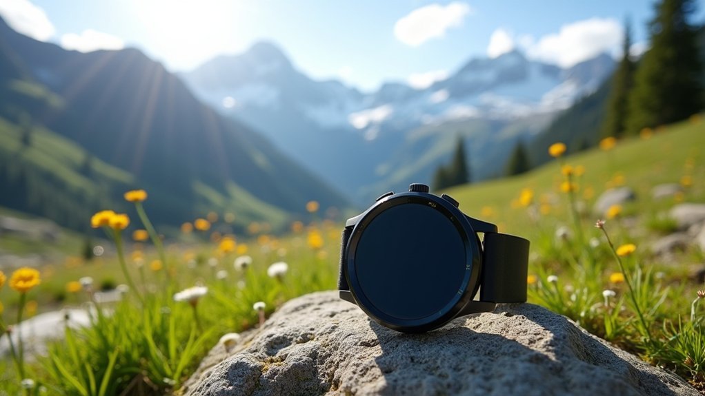
For highest hiking accuracy, the Garmin Fenix 7 Pro leads the pack with multi-constellation GNSS support and exceptional mapping capabilities. The Coros Vertix 2S and Suunto Vertical Titanium Solar also deliver impressive precision in challenging environments. You’ll get the best results by enabling multi-band GPS, properly positioning your watch on your wrist, and regularly calibrating the barometric altimeter. Discover how these advanced features can transform your wilderness navigation experience.
Understanding GPS Accuracy in Smartwatches

When you’re relying on a smartwatch to navigate wilderness trails, understanding how GPS accuracy works becomes essential for your safety and enjoyment. Your watch’s positioning precision depends heavily on signal quality from satellites overhead.
Several factors determine accuracy: The quality of your device’s antenna, the number of satellite constellations it can access (GPS, GLONASS, Galileo), and the software processing the location data.
GPS precision hinges on antenna quality, multi-constellation access, and sophisticated data processing algorithms.
Premium hiking watches often leverage multiple satellite systems simultaneously for better precision. Watches with multi-band GPS technology provide enhanced accuracy in challenging environments. Your watch’s correction technologies like WAAS can further enhance accuracy by adjusting for signal errors.
Remember that even the best devices face challenges in dense forests or deep valleys where signals struggle to penetrate. Understanding these limitations helps you use your smartwatch effectively while maintaining proper hiking awareness.
Key Features That Enhance Hiking Navigation Precision
When hiking through challenging terrain, your smartwatch’s multi-GNSS capability connects to multiple satellite systems simultaneously for dramatically improved location accuracy.
Real-time map displays with topographic details help you make confident trail decisions, especially when paired with offline syncing before remote adventures. This functionality works independently as internet is not required for GPS watches to provide navigation data.
Your watch’s barometric altimeter provides reliable elevation data that complements GPS positioning, giving you more precise vertical tracking even when satellite signals weaken in valleys or dense forests.
Multi-GNSS Signal Support
As modern hikers venture deeper into remote terrain, the multi-GNSS capabilities of today’s GPS smartwatches have revolutionized trail navigation accuracy. Your watch isn’t just using American GPS satellites—it’s tapping into multiple global networks simultaneously, ensuring you’ll maintain positioning even in challenging environments. The GPS system, which operates in the L-Band frequency, provides excellent signal penetration through forest canopies and various weather conditions.
| GNSS System | Coverage Region | Key Benefit for Hiking |
|---|---|---|
| GPS (US) | Global | Baseline satellite coverage |
| GLONASS (Russia) | Global, stronger at high latitudes | Better performance in northern forests |
| Galileo (EU) | Global | Higher precision, often <1m accuracy |
| BeiDou (China) | Global, strongest in Asia | Additional satellites in dense terrain |
| QZSS (Japan) | Asia-Pacific | Enhanced canyon/valley coverage |
Multi-frequency reception further enhances accuracy by correcting atmospheric errors and mitigating signal reflections, potentially achieving sub-meter precision where single-frequency systems struggle.
Real-Time Map Accuracy
Modern GPS smartwatches deliver impressive real-time map accuracy that transforms how hikers traverse challenging terrain.
The Garmin fenix 8 AMOLED Sapphire stands out with its 454×454 pixel display that reveals fine topographic details even in bright sunlight.
You’ll appreciate the touchscreen interface for intuitive map zooming when maneuvering through tricky trail junctions. Pre-loaded maps on Sapphire versions eliminate the need for cell coverage when you’re deep in remote areas.
The combination of advanced GPS antennas and quick signal lock-on means your position updates seamlessly as you move.
For multi-day adventures, models with solar charging capabilities guarantee your navigation remains reliable without worrying about battery life. The Garmin Instinct 2 Solar offers unlimited battery life in smartwatch mode when exposed to sufficient sunlight conditions.
When paired with turn-by-turn directions and breadcrumb trails, you’ll stay confidently on course through even the most challenging wilderness routes.
Barometric Altimeter Reliability
The barometric altimeter represents a critical component in today’s advanced GPS smartwatches, particularly enhancing elevation tracking accuracy during hikes.
Unlike GPS-only altitude measurements, barometric technology measures air pressure changes to provide more precise elevation data, especially in challenging terrain.
You’ll need to calibrate your watch’s barometric altimeter initially, as weather conditions can affect readings.
High-end models from Garmin, Suunto, and Coros offer automatic calibration features that adjust for atmospheric pressure changes.
For maximum accuracy, look for watches that combine barometric data with GPS augmentation.
Be aware that barometric readings may drift during extended hikes due to weather pattern shifts.
The most reliable watches incorporate multi-system GPS technologies alongside their altimeters, ensuring you maintain accurate elevation data even when atmospheric conditions fluctuate.
Recent field tests revealed that Garmin, COROS, and Apple watches demonstrated superior elevation accuracy when tracking elevation gain during challenging hikes.
Top 5 Most Accurate GPS Smartwatches for 2023
Finding the perfect GPS smartwatch for hiking requires balancing accuracy, battery life, and durability. The Garmin Fenix 7 Pro leads the pack with exceptional GPS precision and extensive mapping features that serious hikers will appreciate.
Accurate GPS tracking and rugged design make the Fenix 7 Pro a trailblazer’s ultimate companion on any expedition.
For those wanting excellent battery performance, the Garmin Instinct 2 Solar delivers reliable tracking while harnessing solar power. This affordable option provides up to 28 days of battery life with straightforward functionality that beginners will find easy to navigate.
The Coros Vertix 2S offers impressive accuracy specifically optimized for outdoor adventures, though with fewer bells and whistles than Garmin models.
The Suunto Vertical Titanium Solar combines durability with solar charging, making it ideal for multi-day expeditions.
Rounding out the top five, the Casio Pro Trek 340SC-2 appeals to minimalists seeking reliable GPS functionality without unnecessary complexities.
Your choice ultimately depends on which features matter most for your specific hiking needs.
Garmin vs. Coros vs. Suunto: Accuracy Showdown

When comparing the top hiking GPS smartwatches, accuracy becomes the true differentiator for serious trail enthusiasts. Garmin typically leads with superior multi-band GPS technology and smoother tracking in challenging environments like dense forests or steep mountain passes.
While Coros offers impressive battery efficiency, it sometimes sacrifices precision, recording slightly shorter distances on long hikes compared to competitors. Coros watches average an impressive 30 hours of GPS battery life while maintaining their streamlined feature set.
Suunto holds its own with reliable GPS but truly excels in elevation tracking with precise barometric altimeters.
For elevation data, Suunto provides detailed 3-foot increment readings, though Garmin’s combined GPS-barometric approach yields better results on complex ascents.
Battery life affects accuracy too—Coros may reduce sampling rates to extend battery, while Suunto’s year-long battery assures consistent performance without recharging concerns during extended adventures.
How Satellite Technology Affects Trail Tracking Performance
Your GPS smartwatch’s accuracy relies heavily on its ability to receive signals from multiple satellite networks like GPS, GLONASS, and Galileo simultaneously.
When you’re hiking through dense forests or deep canyons, satellite signals can be blocked or reflected, causing your position to drift or jump erratically on the map. Signal multipath effects are particularly problematic in these environments, creating false readings when signals bounce off surrounding terrain.
The quality of your tracking depends on precise trilateration calculations from at least four satellites, which is why watches with advanced chipsets that can process more satellite data typically deliver more reliable trail maps even in challenging conditions.
Multi-GNSS Signal Reception
Although standard GPS technology has served hikers well for years, multi-GNSS reception represents a significant advancement in trail tracking accuracy. This technology allows your smartwatch to connect with multiple satellite systems simultaneously, dramatically improving positioning precision in challenging terrain.
When evaluating GPS smartwatches for hiking, consider these multi-GNSS advantages:
- Maintains tracking accuracy under dense tree canopies where single-system GPS often fails
- Reduces position errors by cross-referencing multiple satellite constellations
- Provides continuous navigation even when some satellite signals become obstructed
- Creates more accurate distance measurements and elevation data on complex trails
Tests have shown that Garmin devices operating in multi-band mode with four satellite systems (GPS, GLONASS, Beidou, and Galileo) demonstrate superior accuracy results even in challenging conditions.
Garmin and Suunto lead the market with robust multi-GNSS implementation, while Apple Watches typically lack this capability.
Remember that utilizing multiple satellite systems may increase battery consumption, so look for models with efficient power management.
Terrain Obstruction Effects
While multi-GNSS technology enhances satellite reception, terrain features can greatly undermine even the most advanced GPS smartwatches. When hiking through dense foliage, steep valleys, or urban canyons, your watch’s accuracy can plummet as signals get blocked or reflected, creating multipath errors. GPS drift occurs more prominently in these areas with degraded signals, affecting the reliability of your location data.
| Terrain Type | Impact Level | Typical Error |
|---|---|---|
| Dense Forest | Severe | 100+ meters |
| Steep Valleys | High | 50-100 meters |
| Urban Canyons | High | 20-80 meters |
| Open Ridgelines | Low | 3-10 meters |
| Light Canopy | Moderate | 10-30 meters |
You’ll notice these effects most dramatically in elevation readings, which can be off by hundreds of meters in challenging terrain. Many watches now include off-route alerts to help you stay on track when signal quality deteriorates, combining GPS data with accelerometers and compass sensors to maintain reasonable accuracy.
Trilateration Accuracy Factors
How do GPS smartwatches actually pinpoint your location on a trail? They use trilateration, calculating your position based on distances from multiple satellites.
The accuracy of this process depends on several key factors that directly impact your hiking experience.
For ideal trail tracking performance, you’ll need a watch with:
- Strong satellite diversity – models using GPS, GLONASS, and Galileo simultaneously offer superior coverage in challenging terrain
- Advanced signal processing – watches with algorithms that filter multipath effects provide cleaner positioning data
- Quality antenna design – proper placement and sensitivity dramatically improve signal reception
- Multiple accuracy modes – the ability to switch between battery-saving and high-precision settings gives you control based on your needs
The extensive evaluation of GPS watches included rigorous testing on various hiking trails to determine real-world accuracy performance.
The Coros Pace 3 currently leads the market in GPS accuracy for hiking applications.
Environmental Factors Impacting Smartwatch Accuracy
When you’re relying on your GPS smartwatch for navigation during a hike, various environmental elements can greatly affect its accuracy.
Environmental factors can significantly impact the precision of your GPS smartwatch when navigating wilderness trails.
Dense tree canopies and mountain ranges physically block satellite signals, while tall buildings in urban areas create “canyons” that reflect and distort transmissions.
Water bodies and cliff faces cause similar reflection issues, creating multipath errors where your watch receives both direct and bounced signals.
Weather conditions matter too—heavy cloud cover, solar flares, and ionospheric disturbances can all degrade signal quality.
Your physical environment isn’t the only concern.
Your watch’s position matters—holding it close to your body or under thick clothing reduces reception. Consumer-grade GPS receivers typically have accuracy around 3-meters under ideal conditions, so environmental challenges further reduce precision.
Even running in a dense group of hikers can sometimes interfere with ideal signal capture.
Value-to-Accuracy Ratio: Budget-Friendly Options

Finding a GPS smartwatch that balances cost with reliable tracking doesn’t mean you’ll need to empty your wallet. Several manufacturers offer impressive accuracy without premium pricing.
The Garmin Forerunner 55 stands out at $199 with solid GPS capabilities and essential hiking features. For even better value, the Coros Pace 3 delivers exceptional accuracy and battery life at a price point below premium competitors.
If you’re considering budget options, look for these key factors:
- GPS and GLONASS support for reliable navigation in varied terrain
- Minimum 12-hour battery life in GPS tracking mode
- Water resistance rating appropriate for outdoor conditions
- Essential sensors like altimeters for elevation tracking
Budget-friendly brands like Amazfit offer decent tracking for casual hikers, though consistency may vary compared to Garmin or Coros models. For rugged outdoor adventures, the Amazfit T-Rex Pro provides 100m water resistance with a durable design suited for challenging environments.
Optimizing Your Smartwatch Settings for Maximum Precision
To maximize your GPS smartwatch’s accuracy while hiking, proper configuration of settings can make a dramatic difference in tracking quality.
Set GPS intervals to shorter durations (1-5 seconds) for more precise tracking, though this will drain your battery faster. Enable 3D speed and distance features when hiking in varied elevation terrain.
Adjust GPS intervals to record more frequent data points while activating 3D metrics for comprehensive elevation tracking on rugged terrain.
Regularly calibrate your altimeter, especially before hikes and when weather conditions change. Keep your firmware updated to guarantee peak performance and accuracy.
When hiking near obstacles like dense tree canopies or cliff faces, be mindful of potential signal blockage. Consider enabling secondary satellite constellations to maintain connectivity in these challenging environments.
Position your watch properly on your wrist rather than in a pocket, and consider using advanced GPS modes that balance accuracy with battery life for longer expeditions.
Future Technologies Improving Hiking GPS Reliability
While traditional GPS technology has served hikers well for decades, emerging advancements promise to revolutionize the reliability and precision of location tracking in challenging outdoor environments.
GNSS integration combines multiple satellite constellations to reduce signal loss in forests and canyons, pinpointing your location within meters.
The hiking navigation landscape is rapidly evolving with:
- 5G network integration enabling near real-time positioning updates and high-resolution map downloads even in remote areas
- Indoor positioning advances using Wi-Fi, Bluetooth, and UWB to maintain tracking in caves and dense forests
- AI-powered systems that recommend safer routes based on real-time environmental conditions
- Quantum GPS technology that aims to operate independently of satellite signals, providing consistent data in all environments
These innovations complement existing units like the Garmin Montana 700 which offers an impressive vibrant touchscreen for enhanced visibility on sunlit trails.
Frequently Asked Questions
How Often Should I Calibrate My GPS Smartwatch?
You should calibrate your GPS smartwatch after significant location changes, before important hikes, and every 2-4 weeks during regular use. Calibrate more frequently in challenging environments with dense foliage or urban canyons.
Can GPS Accuracy Be Improved With External Antennas?
While external antennas can improve GPS accuracy, most hiking smartwatches don’t support them. You’ll get better results by using multi-GNSS watches with dual-frequency technology instead of adding bulky external hardware to your wrist.
Do Smartwatch GPS Accuracy Ratings Vary Between Different Continents?
No, GPS smartwatch accuracy doesn’t considerably vary between continents. You’ll experience similar performance globally, though local conditions like tree cover, mountains, and urban density can affect your readings regardless of location.
How Significant Is Weight Difference Among Top Hiking Smartwatches?
Weight differences among top hiking smartwatches range from 35g to 70g. You’ll notice this on long treks—lighter watches improve comfort while heavier ones typically offer better battery life and more advanced features.
Are Touchscreen Displays Less Reliable Than Button Interfaces During Hikes?
Yes, touchscreens are typically less reliable when hiking. You’ll find button interfaces perform better in rain, cold, and while wearing gloves. Many premium watches like Garmin’s fenix 8 offer both options for maximum versatility.
In Summary
You’ll find that GPS accuracy in hiking smartwatches ultimately comes down to multi-band GNSS technology and proper calibration. Garmin’s Fenix 7X and Epix models currently lead the pack, but Coros Vertix 2 offers comparable performance at a lower price. Remember, even the most advanced watch needs proper settings adjustment for best results. As satellite technology evolves, you can expect even more precise trail tracking in future models.


Leave a Reply