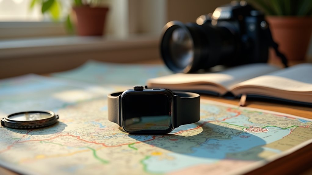
You can plan cycling routes with wearable tech by using apps like Komoot or Ride with GPS that sync with your smartwatch for real-time navigation and performance tracking. Set up your device’s cycling mode to display metrics like heart rate, speed, and distance while accessing offline maps for areas without cell coverage. These apps customize routes based on your fitness data and terrain preferences, while community features help you discover popular trails and safety updates that’ll enhance your cycling experience considerably.
Choosing the Right Apps for Route Planning and Navigation

When planning cycling routes with wearable technology, your choice of navigation app becomes the foundation of your entire riding experience.
You’ll want to evaluate several top-tier options that excel in different areas.
Komoot stands out for cycle touring with its intuitive interface and community-shared routes.
For cyclists seeking seamless tour planning, Komoot delivers an intuitive platform enhanced by valuable community-generated route recommendations.
Ride with GPS offers extensive route creation with precision mapping and turn-by-turn voice navigation.
Strava provides auto-generated routes and user-generated content, though it struggles with terrain classification for gravel or dirt roads.
Essential features include browser-based planning for easier editing, multiple cycling modes for different terrains, offline map support, and device compatibility with Garmin, Wahoo, and other popular bike computers.
Analyze cost models carefully—Komoot offers one-time worldwide map purchases while others require ongoing subscriptions. Planning in 3-4 day segments helps reduce overwhelm and allows for better management of longer touring adventures.
Integrating Smartwatches With Cycling Performance Tracking
You’ll need to configure your smartwatch’s cycling mode before heading out, which optimizes GPS tracking and activates cycling-specific sensors for accurate data collection.
Once you’re riding, your watch displays real-time metrics like speed, distance, heart rate, and elevation directly on your wrist without requiring you to check your phone.
This instant feedback lets you monitor your performance against planned routes and adjust your effort level based on current conditions and fitness goals. Modern smartwatches can connect to power meters via Bluetooth, displaying crucial data like power-to-weight ratio that’s especially valuable for climbing sections of your route.
Smartwatch Cycling Mode Setup
Setting up your smartwatch’s cycling mode transforms it into a powerful performance tracking companion that rivals dedicated bike computers.
You’ll start by unboxing your device and pairing it with your smartphone, then configure essential settings like time, language, and connectivity options.
Next, download cycling-specific apps such as Apple Watch’s Fitness app to customize your workout goals around time, distance, or calories burned.
You can create custom workouts by setting specific intervals that match your training objectives.
For enhanced functionality, pair compatible cycling devices like cadence sensors with brands such as Garmin or Apple Watch. When using a heart rate strap, ensure the battery is fresh as connection issues often stem from low power rather than device compatibility problems.
Configure your preferred data fields including speed, distance, cadence, and heart rate directly on your watch face for quick access during rides.
Real-Time Performance Metrics
Once you’ve configured your smartwatch’s cycling mode, the device becomes a real-time dashboard that displays critical performance data as you ride. Your wrist-based sensors continuously monitor heart rate without external straps, while integrated GPS provides instantaneous speed, distance, and route tracking throughout your journey.
| Metric Type | Real-Time Data | Accuracy Level |
|---|---|---|
| Heart Rate | Continuous monitoring | High for most users |
| Speed/Distance | GPS-based updates | Very high |
| Cadence | Accelerometer estimation | Moderate (external sensors recommended) |
| Elevation | Barometric altimeter | High on advanced models |
You’ll receive live workout notifications for heart rate zones, split times, and pre-set goals, helping you stay on target. The watch’s customizable data fields let you choose which metrics appear during rides, ensuring you focus on the most relevant performance indicators.
Modern smartwatches can seamlessly pair with training peripherals like power meters and external heart rate monitors to provide even more comprehensive performance data during your cycling sessions.
Utilizing GPS and Offline Mapping Features for Safe Navigation

You’ll need reliable GPS accuracy to guarantee your cycling routes guide you safely from point A to point B without dangerous detours.
Offline mapping becomes your backup when cellular coverage drops, letting you navigate remote trails without draining your battery or losing your way.
Real-time safety alerts integrated with your wearable tech can warn you about upcoming hazards, traffic changes, or tricky intersections before they become problems.
Modern route planning tools allow you to customize your cycling experience by adjusting difficulty levels, terrain preferences, and distance requirements before you even start pedaling.
GPS Accuracy Fundamentals
When planning cycling routes with wearable technology, understanding GPS accuracy fundamentals becomes essential for safe and reliable navigation. You’ll typically achieve positional accuracy within 10 meters, with premium devices reaching 1-meter precision. However, elevation data remains less reliable than horizontal positioning.
Environmental factors greatly impact your device’s performance. Urban canyons, dense forests, and mountainous terrain can weaken satellite signals, while multipath interference occurs when signals bounce off nearby surfaces. Weather conditions like heavy rain or ionospheric disturbances also affect signal quality.
| Factor | Impact on Accuracy |
|---|---|
| Signal Strength | Stronger signals provide better precision |
| Environmental Obstacles | Urban/forest areas reduce accuracy |
| Device Quality | High-end devices handle interference better |
| Atmospheric Conditions | Weather affects signal reliability |
| Multipath Interference | Surface reflections decrease precision |
Your device’s sampling rate and algorithms influence data consistency across different platforms. For optimal GPS performance, mount your device on handlebars using recommended cases and keep it away from electronics with magnetic clasps.
Offline Map Benefits
While cellular coverage remains spotty in remote cycling areas, offline maps provide a reliable navigation foundation that doesn’t depend on internet connectivity.
You’ll dramatically reduce data usage during long-distance tours while extending your wearable device’s battery life by eliminating continuous internet requirements.
Downloaded maps guarantee you can navigate confidently through areas with zero connectivity, allowing better route planning by securing specific map sections beforehand.
You’ll avoid expensive roaming charges when crossing regional boundaries, making international cycling tours more affordable.
Your GPS continues providing precise location tracking in offline mode, storing routes for seamless navigation.
Voice guidance keeps you focused on riding rather than constantly checking screens, while waypoint management lets you mark essential stops.
Most premium cycling apps support downloading routes up to 300km in length for extended touring adventures.
This combination creates a robust navigation system that functions regardless of network availability.
Real-Time Safety Alerts
Modern wearable devices transform offline navigation into an active safety system by continuously monitoring your surroundings and delivering instant alerts about potential hazards.
Your GPS-enabled smartwatch or cycling computer tracks your location while scanning for approaching vehicles, using integrated radar systems like Garmin Varia to warn you of cars from behind.
These devices automatically detect collisions and send emergency notifications to your contacts when accidents occur.
You’ll receive real-time traffic updates that redirect you away from congested roads, while crowdsourced incident reports from other cyclists alert you to road hazards ahead. Enhanced visibility features like turn signals integrated into smart helmets help drivers clearly see your intended direction changes during navigation.
Smart helmets with bone conduction audio keep you connected without compromising your ability to hear surrounding traffic, ensuring you stay aware while receiving critical safety information.
Customizing Routes Based on Personal Preferences and Fitness Levels

Although every cyclist has unique fitness goals and riding preferences, wearable technology now makes it possible to create truly personalized routes that adapt to your individual capabilities and aspirations.
Your wearable device tracks extensive historical performance data, enabling customized training plans that incrementally improve your speed, endurance, and heart rate zones. Goal-setting through wearables enhances motivation and helps you systematically progress toward your cycling objectives.
Personalized cycling metrics transform raw ride data into actionable insights that systematically enhance your performance across all training dimensions.
Here’s how you can leverage this technology for ideal route customization:
- Historical Performance Analysis – Your device analyzes past rides to recommend routes matching your current fitness level.
- Real-Time Physiological Monitoring – Heart rate, cadence, and power output data trigger mid-ride route adjustments.
- Terrain Compatibility Matching – Apps filter routes by surface type and technical difficulty based on your skill level.
- Dynamic Algorithm Adaptation – Machine learning models continuously refine suggestions using your feedback and performance data.
Leveraging Community Features for Route Discovery and Sharing
Beyond personalizing routes to your individual fitness profile, tapping into cycling communities opens up a vast network of collective knowledge and real-world route testing that no algorithm can replicate alone.
You’ll discover hidden gems through community forums where cyclists share detailed terrain insights and safety updates. Social media groups provide instant recommendations and real-time hazard alerts, while photo sharing helps you visualize routes before riding.
Challenge leaderboards gamify route exploration, motivating you to try popular community favorites. Many cycling apps now integrate phone tracking technology to provide comprehensive data on all types of cycling trips, not just commuting routes.
Collaborative mapping tools like OpenStreetMap let you contribute route improvements and access crowdsourced data. Community-driven apps aggregate user ratings and reviews, offering algorithmic recommendations based on collective feedback.
This collaborative approach guarantees you’re not just following data points, but benefiting from genuine rider experiences and continuously validated route quality.
Analyzing Performance Data and Metrics for Training Optimization
Once you’ve gathered route data from community insights, transforming that raw information into actionable training improvements requires systematic analysis of your performance metrics.
Your wearable device captures essential data points that’ll help enhance your cycling performance and prevent overtraining.
Key metrics to monitor for training enhancement:
- Heart rate and HRV data – Track your resting heart rate and heart rate variability to assess fitness levels and recovery status.
- Power output measurements – Use real-time power data to maintain ideal effort levels during different training phases.
- Cadence efficiency – Monitor your pedaling rhythm to improve overall cycling technique and performance.
- Recovery indicators – Analyze sleep quality and other recovery metrics to verify you’re ready for your next session. Poor sleep quality affects 41% of elite cyclists despite its recognized importance for performance and recovery.
Frequently Asked Questions
How Long Does Wearable Device Battery Last During Extended Cycling Trips?
You’ll get 24-120 hours of continuous GPS tracking depending on your device. Solar-enabled wearables like Garmin fenix 7X Pro can extend battery life considerably during daylight rides.
Can Wearable Tech Work Without Smartphone Connectivity During Rides?
You can use many wearable devices independently during rides since they’ve built-in GPS for navigation and route tracking. However, you’ll need smartphone connectivity for downloading maps, syncing data, and accessing certain advanced features.
What Happens if GPS Signal Is Lost in Remote Areas?
Your wearable device switches to inertial navigation or dead reckoning, using internal sensors to estimate position. You’ll lose real-time accuracy, but basic tracking continues until GPS reconnects in open areas.
Are Wearable Devices Waterproof Enough for Cycling in Heavy Rain?
Most waterproof wearables with IP67 ratings can handle heavy rain cycling. You’ll get reliable GPS tracking, heart rate monitoring, and route data. However, you should check your device’s specific water resistance specifications before riding.
How Much Data Storage Do Cycling Apps Require on Devices?
You’ll find cycling apps typically require storage equivalent to a few songs on your device. The exact amount depends on your usage frequency, tracking features enabled, and whether you’re storing GPS tracks locally.
In Summary
You’ve now got the tools to transform your cycling experience with wearable tech. Start by selecting apps that match your riding style, then sync your smartwatch for real-time tracking. Don’t forget to download offline maps before heading out. Customize routes based on your fitness goals, tap into community recommendations, and analyze your performance data afterward. Your wearable device isn’t just tracking your ride—it’s optimizing every pedal stroke for better adventures ahead.


Leave a Reply